
Hiking, 21 km
20.9.2026
 Česko
Prachatice (Jihočeský kraj)
Logged on Vrcholovka 35x in total. Peak information here was completed by Bludička, Martin Matějka, Vladimír Grančay a Bouřka.
Perník is part of challenges: Šumavské tisícovky, The Highest Peaks of South Bohemia, Thousanders of the Czech Republic
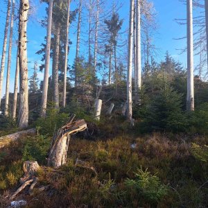
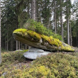
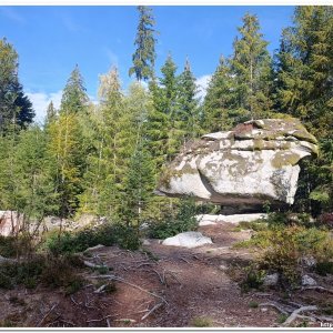
A prominent peak 4.5 km west of Želnavy. An extensive dome-shaped massif with a flat summit, featuring several smaller elevations and rocks. Some of the rocks are named (Viklan, Obří kostka, Kaple). Covered with mixed and spruce forest, with clearings offering views. /tisícovky.cz/
The highest point on the summit rock, measured height according to ags.cuzk.cz is 1053.3 m. The commonly stated height of 1049 m is only the height of the geodetic point (1048.9 m).
There is no chalet on the peak.
Peak is not stroller accessible.
There are no views from the peak.
There is no cable car to this peak.
No special equipment is required for this summit.
Peak is freely accessible.
Nearest peaks: Perník J2 (1052 m, 0.1 km) Perník JZ1 (1044 m, 0.4 km) Perník JZ2 (1045 m, 0.5 km) Perník J1 (1040 m, 0.6 km) Kamenná kráska J (1009 m, 0.7 km) Hlava telete (998 m, 0.8 km) Kamenná kráska (1012 m, 0.8 km) Obří kostky (1004 m, 0.8 km) Nad rozcestím (987 m, 1 km) Perník JV (978 m, 1 km) Nad rozcestím SZ (986 m, 1.1 km) V Ořeší (948 m, 1.1 km) Above the Burned Path V (991 m, 1.2 km) Nad Spálenou cestou (991 m, 1.2 km) Above the Burned Path J (987 m, 1.4 km) Above the Burnt Path SE1 (989 m, 1.4 km) Soutěska lapků (923 m, 1.4 km) Above the Burnt Path SE2 (987 m, 1.5 km) At Hvozdecká Path Z (909 m, 1.5 km) Hvozd J (1051 m, 1.5 km) Above the Burnt Path SE3 (977 m, 1.6 km) At Hvozdecká Path (906 m, 1.7 km) Hvozd JV (945 m, 1.7 km) Soutěska lapků JV (892 m, 1.7 km) Above the Path of Geometers (897 m, 1.8 km) At Hvozdecká Path SE (880 m, 1.9 km) Hvozd (1047 m, 1.9 km) Na Spálené cestě (944 m, 1.9 km) At Idina's Path (853 m, 2 km) Jelenská hora (1069 m, 2 km) Rock Outlook (890 m, 2 km) Uhlířka (857 m, 2.1 km) At Hvozdecká Path NE (833 m, 2.2 km) Jelenský vrch (823 m, 2.3 km) Ovesný vrch (842 m, 2.4 km) Uhlířka V (820 m, 2.4 km) Jelenský les (828 m, 2.5 km) Kristiánova skála (993 m, 2.6 km) Na kuchyni (862 m, 2.6 km) Bor (974 m, 2.7 km) Kristiánova skála SV (854 m, 3 km) Rosenauerův les (962 m, 3.1 km) Hajný vrch (826 m, 3.2 km) Nad Dlouhým Borem (794 m, 3.6 km)
| today | tomorrow | day after tomorrow | |
|---|---|---|---|
| Dawn: | 7:06 | 6:07 | 6:09 |
| Sunrise: | 7:38 | 6:40 | 6:41 |
| Sunset: | 17:58 | 16:56 | 16:54 |
| Dusk: | 18:30 | 17:29 | 17:27 |