
Hiking, 21 km
20.9.2026
 Česko
Prachatice (Jihočeský kraj)
Logged on Vrcholovka 14x in total. Peak information here was completed by Martin Matějka, Vladimír Grančay a Michal Kříž.
Hvozd J is part of challenges: Šumavské tisícovky, The Highest Peaks of South Bohemia, Thousanders of the Czech Republic
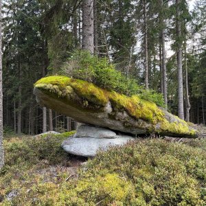
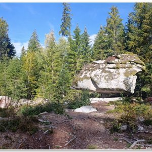
At the summit, there is a rock reaching 1050.9 m according to ČÚZK. The southern peak thus exceeds the northern peak (1047 m)! The previously stated height of 1044 m was underestimated.
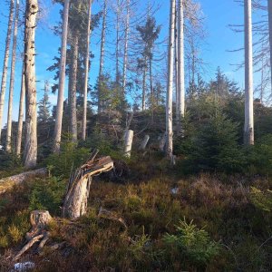
The rock is covered with young spruces, but the surrounding area is deforested and offers views of the entire border ridge from Hochstein to Hochficht. The overall panorama is only disrupted by a few tall trees...
There is no chalet on the peak.
Peak is not stroller accessible.
There are views from the peak.
There is no cable car to this peak.
No special equipment is required for this summit.
Peak is freely accessible.
Nearest peaks: Hvozd (1047 m, 0.4 km) Nad rozcestím SZ (986 m, 0.6 km) Hvozd JV (945 m, 0.7 km) Nad rozcestím (987 m, 0.7 km) Obří kostky (1004 m, 0.8 km) Hlava telete (998 m, 0.9 km) Kamenná kráska (1012 m, 1 km) Kamenná kráska J (1009 m, 1.1 km) Kristiánova skála (993 m, 1.3 km) At Hvozdecká Path Z (909 m, 1.4 km) Kristiánova skála SV (854 m, 1.5 km) Perník (1053 m, 1.5 km) At Hvozdecká Path (906 m, 1.6 km) Bor (974 m, 1.6 km) Perník J2 (1052 m, 1.6 km) At Hvozdecká Path NE (833 m, 1.7 km) Jelenská hora (1069 m, 1.7 km) Perník JZ1 (1044 m, 1.8 km) V Ořeší (948 m, 1.9 km) Perník JZ2 (1045 m, 2 km) At Hvozdecká Path SE (880 m, 2.1 km) Perník J1 (1040 m, 2.1 km) Perník JV (978 m, 2.1 km) Kristiánova skála SZ1 (858 m, 2.2 km) Kristiánova skála S (816 m, 2.3 km) Soutěska lapků (923 m, 2.3 km) Kristiánova skála SZ2 (833 m, 2.4 km) At Idina's Path (853 m, 2.5 km) Above the Burned Path V (991 m, 2.6 km) Nad Spálenou cestou (991 m, 2.6 km) Soutěska lapků JV (892 m, 2.6 km) Above the Burned Path J (987 m, 2.7 km) Above the Burnt Path SE1 (989 m, 2.7 km) Above the Burnt Path SE2 (987 m, 2.8 km) Rock Outlook (890 m, 2.8 km) Above the Bear Path (827 m, 2.9 km) Above the Burnt Path SE3 (977 m, 3 km) Uhlířka (857 m, 3 km) Spálený (818 m, 3.1 km) Na Spálené cestě (944 m, 3.2 km) Uhlířka V (820 m, 3.2 km) Above the Path of Geometers (897 m, 3.3 km) Nad Rašeliništěm (760 m, 3.3 km) Ovesný vrch (842 m, 3.5 km)
| today | tomorrow | day after tomorrow | |
|---|---|---|---|
| Dawn: | 7:04 | 7:06 | 6:07 |
| Sunrise: | 7:37 | 7:38 | 6:40 |
| Sunset: | 18:00 | 17:58 | 16:56 |
| Dusk: | 18:32 | 18:30 | 17:29 |