




Via ferrata
po, 22.8.2022, 0:00
 Německo
Logged on Vrcholovka 3x in total. Vrchol Vollkarspitze was added here by Tomas and info was completed by Jan Blažej.
Summit on the Jubiläumsgrat ridge
Bivak Grathütterl - limited capacity of 12, open, protection against adverse weather
Peak is not stroller accessible.
Stunning views of the entire Jubiläumsgrat and the Hollental valley
There is no cable car to this peak.
Via ferrata set, helmet, rope, belaying and rappelling equipment
Along the Jubiläumsgrat ridge. Watch the weather and time. Need plenty of water, cannot be replenished. Sleeping on the ridge is very limited, spots can be found, but tents cannot be set up.
Nearest peaks: Äußere Höllentalspitze (2715 m, 0.5 km) Hochblassen (2706 m, 0.7 km) Mittlere Höllentalspitze (2740 m, 1.1 km) Blassenkopf (2628 m, 1.2 km) Alpspitze (2628 m, 1.3 km) Blassenspitze (2420 m, 1.5 km) Innere Höllentalspitze (2741 m, 1.8 km) Höllentorkopf (2150 m, 2.1 km) Bernadeinkopf (2144 m, 2.2 km) Hoher Gaif (2288 m, 2.2 km) Osterfelderkopf (2057 m, 2.2 km) Aschenköpfe (1973 m, 2.3 km) Kleiner Wanner (2548 m, 2.8 km) Hoher Kamm (2375 m, 3.1 km) Hochwanner (2744 m, 3.2 km) Östlicher Gatterlkopf (2475 m, 3.8 km)
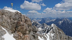 Výstup na pyramidovou horu Alpspitze v Bavorsku
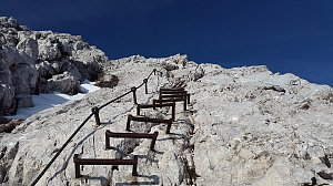 Výstup na Zugspitze feratou Höllental
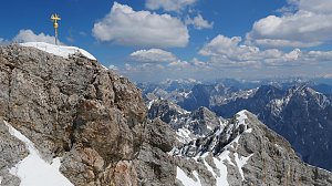 Hřebenový přechod Zugspitze – Alpspitze (Jubiläusgratweg)
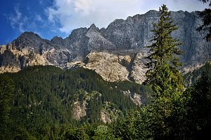 Výstup na Zugspitze z rakouské strany
Túra soutěskou Höllentalklamm ve čtyřech ročních obdobích
 Výstup na Hohe Munde (2662 m) v pohoří Wetterstein
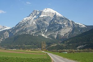
 Hammersbach: Alpspix
 Grainau › South-East: Zugspitze - Zugspitzeplat
 Grainau: Bayerische Zugspitzbahn - Blick über das Höllental nach Osten
 Grainau: Zugspitze Garmisch-Partenkirchen
 Grainau: Bayerische Zugspitzbahn - Blick vom Gipfel nach Norden
 Grainau: Wetterwarte Zugspitze - Blick über das Zugspitzplatt nach Süden
 Grainau: Seilbahn Zugspitze - Blick zum Gipfel von Westen
 Grainau: Wetterwarte Zugspitze - Blick über den Gipfel nach Osten
 Gemeinde Ehrwald: Ehrwald, Zugspitze - Tiroler Zugspitzbahn Bergstation
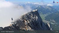 Gemeinde Ehrwald: Ehrwald, Zugspitze - Tiroler Zugspitzbahn Bergstation
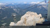 Gemeinde Ehrwald: Ehrwald, Zugspitze - Tiroler Zugspitzbahn Bergstation
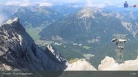 Grainau: Ehrwald, Zugspitze - Tiroler Zugspitzbahn Bergstation
 Garmisch-Partenkirchen: Sonnalpin - Gletscher-Skigebiet Zugspitze - Blick zum Schneefernerkopf
 Grainau: Seilbahn Zugspitze - Weltrekord-Stütze - Blick über den Eibsee nach Norden
 Hammersbach: Kreuzeck Bergstation - Garmisch-Classic - Blick zur Alpspitze und Zugspitze
 Hammersbach: Kandahar-Express am Kreuzjoch - Garmisch-Classic - Blick nach Nordosten
 Grainau: Bayerische Zugspitzbahn - Seilbahn Zugspitze - Talstation
 Gemeinde Leutasch: Seefeld - Leutasch Rotmoos
 Grainau: Eibsee-Hotel - Blick nach Südwesten zur Zugspitze
 Hammersbach
 Gemeinde Mieming: Ehrwald, Zugspitze - Feldernalm
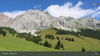 Gemeinde Mieming: Ehrwald, Zugspitze - Feldernalm
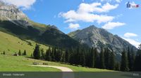 Gemeinde Mieming: Ehrwald, Zugspitze - Feldernalm
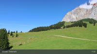 Gemeinde Ehrwald: Ehrwald, Zugspitze - Feldernalm
 Grainau: Dorf - Grosser und kleiner Waxenstein
 Grainau › South: Zugspitze
 Grainau: Garmisch - Partenkirchen
 Garmisch-Partenkirchen: Hausberg - Garmisch-Classic - Blick nach Südwesten

| today | tomorrow | day after tomorrow | |
|---|---|---|---|
| Dawn: | 7:16 | 6:17 | 6:19 |
| Sunrise: | 7:47 | 6:49 | 6:50 |
| Sunset: | 18:12 | 17:10 | 17:09 |
| Dusk: | 18:43 | 17:42 | 17:40 |