Col Alt (1980 m a.s.l., Fanes)
Register and log summit
Weather Col Alt

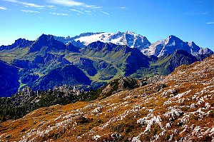
About peak Col Alt
 Itálie
Logged on Vrcholovka 2x in total. Vrchol Col Alt was added here by Nojby and info was completed by Martin Matějka a Jan Blažej.
Help others and .
- Chalet/accommodation
-
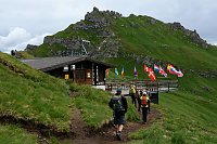
There is a chalet on the peak.
- Stroller access
-
This peak is accessible with a stroller.
- Views
-
There are views from the peak.
- Cable car
-
8-MGD Col Alto
- Equipment
-
No special equipment is required for this summit.
- Accessibility
-
Peak is freely accessible.
Nearest peaks: Piz la Ila (2078 m, 1.7 km) Piz Bioch (2079 m, 1.8 km) Sassongher (2665 m, 2.4 km) Pralongiá (2109 m, 3.2 km)
Routes nearby
(elevation gain 1300 m, 10 km)
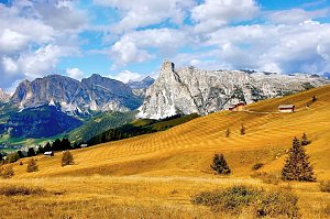 Výstup na Piz Boe - nejlehčí třítisícovku v Dolomitech
(elevation gain 1000 m, 10 km)
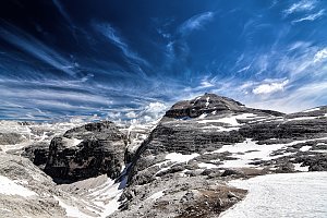 Výstup na Piza da les Diesc v Dolomitech
(elevation gain 3000 m, 40 km)
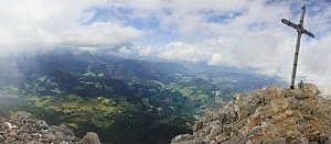 Feratová túra hřebenem Padon v Dolomitech
(elevation gain 1500 m, 10 km)
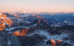 Marmolada - výstup na nejvyšší vrchol Dolomit
(elevation gain 1400 m, 9 km)

Webcams
( 1 km)
 Corvara in Badia - Corvara: Hotel Arkadia
( 1.4 km)
 Badia - Abtei: Alta - Rifugio Ütia de Bioch
(2064 m a.s.l., 1.8 km)
 Badia - Abtei: La Villa, Alta - Piz La Ila
( 1.8 km)
 Badia - Abtei: La Villa, Alta - Piz La Ila
( 1.8 km)
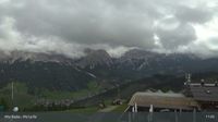 Badia - Abtei: La Villa, Alta - Piz La Ila
( 1.8 km)
 Badia - Abtei: La Villa, Alta - Piz La Ila
( 1.8 km)
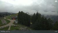 Corvara in Badia - Corvara: Badia II, Alta Badia - Piz La Ila Moritzino
( 1.8 km)
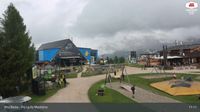 Badia - Abtei: Alta - Club Moritzino
(2075 m a.s.l., 1.9 km)
 Calfosch - Kolfuschg - Colfosco: Calfosch - Impianti Colfosco Spa
(1627 m a.s.l., 2.4 km)
 Corvara in Badia - Corvara
( 2.5 km)
 Calfosch - Kolfuschg - Colfosco: Sassongher
( 2.5 km)
 San Cassiano: Alta Badia - Piz Sorega
( 2.6 km)
 La Villa: Alta Badia − La Viila − Piste Gran Risa
(1434 m a.s.l., 2.9 km)
 Corvara in Badia - Corvara › South-West
(1654 m a.s.l., 3.1 km)
 Colfosco
(1686 m a.s.l., 3.3 km)
 Calfosch - Kolfuschg - Colfosco: Alta Badia - Janin
( 3.3 km)
 Calfosch - Kolfuschg - Colfosco: Alta Badia - Janin
( 3.3 km)
 Calfosch - Kolfuschg - Colfosco: Alta Badia - Janin
( 3.3 km)
 Altino: La Villa
(1419 m a.s.l., 3.4 km)
 La Villa: Hotel Dolasilla
(1458 m a.s.l., 3.4 km)
 Altino: La Villa in Badia
( 3.7 km)
 Corvara in Badia - Corvara: Alta Badia - Boé
( 3.7 km)
 Corvara in Badia - Corvara: Alta Badia - Boé
( 3.7 km)
 Corvara in Badia - Corvara: Alta Badia - Boé
( 3.7 km)
 San Cassiano: Alta Badia - La Villa
(1460 m a.s.l., 3.8 km)
 Kastelruth - Castelrotto: Seis am Schlern - Mezdi Bergstation
( 3.9 km)
 Seis am Schlern - Siusi allo Sciliar: Mezdi Bergstation
( 3.9 km)
 Livinallongo del Col di Lana › South: Marmolada
( 4.2 km)
 Arabba: Marmolada - Bec de Roces
( 4.9 km)
 Livinallongo del Col di Lana: Arabba - Bec de Roces
(2056 m a.s.l., 5 km)
 Livinallongo del Col di Lana: Arabba rifugio Burz
(2078 m a.s.l., 5 km)
 Pedraces: Alta Badia
(1339 m a.s.l., 5.2 km)
 Selva - Wolkenstein - Selva di Val Gardena › South: Rifugio Puez
( 6 km)
 Abtei-Badia: Alta − Pedraces − Dolomites
(1337 m a.s.l., 6.1 km)
 Badia - Abtei
(1333 m a.s.l., 6.2 km)
 Arabba: Marmolada - Rifugio Burz
( 6.4 km)
 Arabba: Rifugio Monte Burz
( 6.4 km)
 San Martin de Tor - San Martino in Badia - St. Martin in Thurn › South-East: Parco Naturale Puez Odle
(2138 m a.s.l., 6.8 km)

Sun
| today | tomorrow | day after tomorrow | |
|---|---|---|---|
| Dawn: | 7:10 | 7:11 | 6:13 |
| Sunrise: | 7:41 | 7:42 | 6:44 |
| Sunset: | 18:12 | 18:10 | 17:08 |
| Dusk: | 18:43 | 18:41 | 17:39 |