Špičník (1351 m a.s.l., Šumava)
Register and log summit
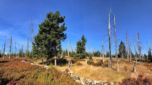

About Špičníku
 Česko
Klatovy (Plzeňský kraj)
Logged on Vrcholovka 13x in total. Peak information here was completed by Vladimír Grančay, Martin Matějka a Mila B..
Špičník is part of challenges: Šumavské tisícovky, The Highest Peaks of Plzeň Region, Thousanders of the Czech Republic
Mount Špičník consists of two summit plateaus. On the Czech side, it has an elevation of 1351 meters, while the Bavarian side is one meter lower. The saddle (1340 m) between the two summit plateaus marks the state border.
- Chalet/accommodation
-
There is no chalet on the peak.
- Stroller access
-
Peak is not stroller accessible.
- Views
-
There are views from the peak.
- Cable car
-
There is no cable car to this peak.
- Equipment
-
No special equipment is required for this summit.
- Accessibility
-
Area with restricted access in Šumava National Park, less than 200 meters from the border trail, which is accessible from July 15 to November 15.
Nearest peaks: Grosser Spitzberg (1350 m, 0.4 km) Blatný vrch (1376 m, 1.2 km) Blatný vrch S (1368 m, 1.2 km) Studená hora JZ (1275 m, 1.9 km) Studená hora (1302 m, 2 km) Studená hora Z (1226 m, 2.8 km) Studená hora S1 (1203 m, 3.1 km)
Routes nearby
(elevation gain 700 m, 12 km)
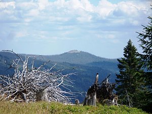 Výstup okruhem na Velký Roklan v německé části Šumavy
(elevation gain 1070 m, 17 km)
Webcams on Špičníku
Cameras provided by windy.com
Sun
| today | tomorrow | day after tomorrow | |
|---|---|---|---|
| Dawn: | 7:05 | 7:06 | 7:08 |
| Sunrise: | 7:37 | 7:39 | 7:40 |
| Sunset: | 18:03 | 18:01 | 18:00 |
| Dusk: | 18:35 | 18:34 | 18:32 |