




Hiking, 13 km
20.7.2025
 Itálie
Logged on Vrcholovka 3x in total. Vrchol Sasso Piatto was added here by Lukáš Svrčina and info was completed by Martin Matějka, Jiří Králík a Jan Blažej.
From the south, the normal route. From the north, via ferrata B/C.
German name Plattkofel.
There is no chalet on the peak.
Peak is not stroller accessible.
There are views from the peak.
There is no cable car to this peak.
No special equipment is required for this summit.
Peak is freely accessible.
Nearest peaks: Grohmannspitze (3126 m, 1.3 km) Langkofel / Saslonch (3181 m, 1.9 km)
 Okružní výšlap náhorními loukami přes Secedu
Výstup na zubatý Sass Rigais v Dolomitech
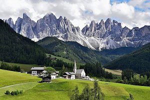
 Kastelruth - Castelrotto: Seis am Schlern - Florianlift Bergstation
 Selva - Wolkenstein - Selva di Val Gardena: Val Gardena - Citta dei Sassi
 Selva - Wolkenstein - Selva di Val Gardena
 Canazei
 Selva - Wolkenstein - Selva di Val Gardena: Val Gardena Sasso Levante
 Campitello di Fassa: Sella Pass - Col Rodella a Parte - Langkofel - Sasso Pordoi
 Campitello di Fassa: Canazei - Col Rodella
 Selva - Wolkenstein - Selva di Val Gardena › West: Val Gardena/Gröden - Piz Sella
 Selva - Wolkenstein - Selva di Val Gardena: Val Gardena Piz Sella
 Selva - Wolkenstein - Selva di Val Gardena: Sella Pass
 Selva - Wolkenstein - Selva di Val Gardena: Val Gardena/Gröden - Ciampinoi
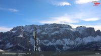 Selva - Wolkenstein - Selva di Val Gardena: Trentino - Alto Adige - Ciampinoi panomax-hd
 Santa Cristina Gherdeina - St. Christina in Groden - Santa Cristina Valgardena: Monte Pana
 Santa Cristina Gherdeina - St. Christina in Groden - Santa Cristina Valgardena: Monte Pana
 Selva - Wolkenstein - Selva di Val Gardena: Val Gardena - Piz Seteur Sassolungo
 Santa Cristina Gherdeina - St. Christina in Groden - Santa Cristina Valgardena: St. Christina, Val Gardena/Gröden - Monte Pana
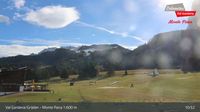 Campitello di Fassa: Campo scuola di sci a
 Campitello di Fassa
 Sëlva: Plan de Gralba − Selva/Wolkenstein − Val Gardena/Gröden
 Campitello di Fassa › North-west: pizzeria camping Miravalle (La Stua De Tate)
 Selva - Wolkenstein - Selva di Val Gardena: Val Gardena Plan de Gralba
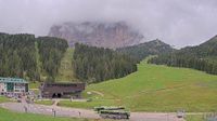 Santa Cristina Gherdeina - St. Christina in Groden - Santa Cristina Valgardena
 Santa Cristina Val Gardena: S. Cristina − Val Gardena/Gröden
 Santa Cristina Gherdeina - St. Christina in Groden - Santa Cristina Valgardena: Dorfhotel Beludei - St. Christina - Gröden
 Santa Cristina Gherdeina - St. Christina in Groden - Santa Cristina Valgardena: S-Cristina
 Santa Cristina Gherdeina - St. Christina in Groden - Santa Cristina Valgardena
 Selva - Wolkenstein - Selva di Val Gardena: Trentino - Alto Adige - Seceda panomax-hd
 Santa Cristina Gherdeina - St. Christina in Groden - Santa Cristina Valgardena › South: Funivia Saslong Spa - Langkofel - Plattkofel
 Canazei
 Canazei
 Sëlva: Wolkenstein
 Selva - Wolkenstein - Selva di Val Gardena: Hotel Jägerheim
 Selva - Wolkenstein - Selva di Val Gardena: in Gröden
 Selva - Wolkenstein - Selva di Val Gardena: Hotel Jägerheim - St. Christina in Gröden
 Santa Cristina Gherdeina - St. Christina in Groden - Santa Cristina Valgardena: St. Christina, Val Gardena/Gröden - Col Raiser
 Selva - Wolkenstein - Selva di Val Gardena: St. Christina, Val Gardena/Gröden - Col Raiser
 Santa Cristina Gherdeina - St. Christina in Groden - Santa Cristina Valgardena: St. Christina, Val Gardena/Gröden - Col Raiser
 Selva - Wolkenstein - Selva di Val Gardena: St. Christina, Val Gardena/Gröden - Col Raiser
 Urtijei - St. Ulrich in Groden - Ortisei › South-east: Langkofel - Alpe di Siusi - Sellaronda
 Urtijei - St. Ulrich in Groden - Ortisei: Langkofel - Alpe di Siusi
 Selva - Wolkenstein - Selva di Val Gardena: Val Gardena, Dolomites - Ski Town and Scenic Views
 Urtijei - St. Ulrich in Groden - Ortisei: Jakoberhof
 Urtijei - St. Ulrich in Groden - Ortisei: Jakoberhof

| today | tomorrow | day after tomorrow | |
|---|---|---|---|
| Dawn: | 6:13 | 6:15 | 6:16 |
| Sunrise: | 6:44 | 6:46 | 6:47 |
| Sunset: | 17:09 | 17:08 | 17:06 |
| Dusk: | 17:40 | 17:39 | 17:37 |




