Grohmannspitze (3126 m a.s.l., Langkofel)
Register and log summit


About peak Grohmannspitze
 Itálie
Peak information here was completed by Martin Matějka, Jiří Králík a Jan Blažej.
IT
Difficulty II/C-31.III-A
- Chalet/accommodation
-
There is no chalet on the peak.
- Stroller access
-
Peak is not stroller accessible.
- Views
-
There are views from the peak.
- Cable car
-
There is no cable car to this peak.
- Equipment
-
Special equipment is required for this summit.
- Accessibility
Nearest peaks: Sasso Piatto (2958 m, 1.3 km) Langkofel / Saslonch (3181 m, 1.6 km) Col Rodella (2484 m, 2 km) Piz Sella (2284 m, 2.7 km) Ciampinoi (2254 m, 3.3 km)
Routes nearby
(elevation gain 1250 m, 20 km)
 Výstup na Piz Boe - nejlehčí třítisícovku v Dolomitech
(elevation gain 1000 m, 10 km)
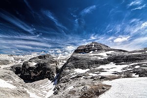 Okružní výšlap náhorními loukami přes Secedu
(elevation gain 1050 m, 15 km)
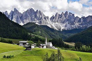
Výstup na zubatý Sass Rigais v Dolomitech(elevation gain 1550 m, 18 km)
Mountain chalets
Webcams
(2249 m a.s.l., 1.6 km)
 Canazei
( 1.6 km)
 Selva - Wolkenstein - Selva di Val Gardena
( 1.6 km)
 Selva - Wolkenstein - Selva di Val Gardena: Val Gardena Sasso Levante
(2176 m a.s.l., 1.8 km)
 Campitello di Fassa: Canazei - Col Rodella
(2388 m a.s.l., 2 km)
 Campitello di Fassa: Sella Pass - Col Rodella a Parte - Langkofel - Sasso Pordoi
(2353 m a.s.l., 2 km)
 Selva - Wolkenstein - Selva di Val Gardena: Sella Pass
(2228 m a.s.l., 2.2 km)
 Selva - Wolkenstein - Selva di Val Gardena: Val Gardena Piz Sella
( 2.7 km)
 Selva - Wolkenstein - Selva di Val Gardena › West: Val Gardena/Gröden - Piz Sella
( 2.7 km)
 Selva - Wolkenstein - Selva di Val Gardena: Val Gardena - Piz Seteur Sassolungo
(1978 m a.s.l., 3 km)
 Kastelruth - Castelrotto: Seiser Alm - Zallinger - Blick nach Westen zum Schlern
(2041 m a.s.l., 3.4 km)
 Selva - Wolkenstein - Selva di Val Gardena: Trentino - Alto Adige - Ciampinoi panomax-hd
(2228 m a.s.l., 3.5 km)
 Selva - Wolkenstein - Selva di Val Gardena: Val Gardena/Gröden - Ciampinoi
( 3.5 km)
 Kastelruth - Castelrotto: Seis am Schlern - Florianlift Bergstation
( 3.8 km)
 Sëlva: Plan de Gralba − Selva/Wolkenstein − Val Gardena/Gröden
(1775 m a.s.l., 3.9 km)
 Selva - Wolkenstein - Selva di Val Gardena: Val Gardena Plan de Gralba
( 3.9 km)
 Campitello di Fassa: Campo scuola di sci a
(1415 m a.s.l., 3.9 km)
 Campitello di Fassa
( 4 km)
 Campitello di Fassa › North-west: pizzeria camping Miravalle (La Stua De Tate)
( 4.1 km)
 Canazei › West
(1728 m a.s.l., 4.4 km)
 Santa Cristina Gherdeina - St. Christina in Groden - Santa Cristina Valgardena: Monte Pana
( 4.6 km)
 Santa Cristina Gherdeina - St. Christina in Groden - Santa Cristina Valgardena: Monte Pana
( 4.6 km)
 Canazei
(1455 m a.s.l., 4.7 km)
 Canazei
(1450 m a.s.l., 4.7 km)
 Santa Cristina Gherdeina - St. Christina in Groden - Santa Cristina Valgardena: St. Christina, Val Gardena/Gröden - Monte Pana
( 4.7 km)
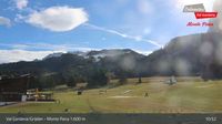 Selva - Wolkenstein - Selva di Val Gardena: Trentino - Alto Adige - Seceda panomax-hd
(1599 m a.s.l., 4.8 km)
 Santa Cristina Val Gardena: S. Cristina − Val Gardena/Gröden
(1449 m a.s.l., 5.5 km)
 Santa Cristina Gherdeina - St. Christina in Groden - Santa Cristina Valgardena
(1395 m a.s.l., 5.5 km)
 Santa Cristina Gherdeina - St. Christina in Groden - Santa Cristina Valgardena › South: Funivia Saslong Spa - Langkofel - Plattkofel
(1450 m a.s.l., 5.6 km)
 Santa Cristina Gherdeina - St. Christina in Groden - Santa Cristina Valgardena: S-Cristina
(1493 m a.s.l., 5.6 km)
 Santa Cristina Gherdeina - St. Christina in Groden - Santa Cristina Valgardena
( 5.6 km)
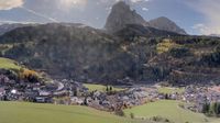 Santa Cristina Gherdeina - St. Christina in Groden - Santa Cristina Valgardena: Dorfhotel Beludei - St. Christina - Gröden
(1425 m a.s.l., 5.6 km)
 Sëlva: Wolkenstein
(1780 m a.s.l., 5.9 km)
 Selva - Wolkenstein - Selva di Val Gardena: in Gröden
( 5.9 km)
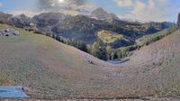 Selva - Wolkenstein - Selva di Val Gardena: Hotel Jägerheim
(1543 m a.s.l., 6 km)
 Selva - Wolkenstein - Selva di Val Gardena: Hotel Jägerheim - St. Christina in Gröden
( 6 km)
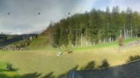 Selva - Wolkenstein - Selva di Val Gardena: Val Gardena, Dolomites - Ski Town and Scenic Views
( 6.1 km)
 Santa Cristina Gherdeina - St. Christina in Groden - Santa Cristina Valgardena: St. Christina, Val Gardena/Gröden - Col Raiser
( 6.1 km)
 Selva - Wolkenstein - Selva di Val Gardena: St. Christina, Val Gardena/Gröden - Col Raiser
( 6.1 km)
 Santa Cristina Gherdeina - St. Christina in Groden - Santa Cristina Valgardena: St. Christina, Val Gardena/Gröden - Col Raiser
( 6.1 km)
 Selva - Wolkenstein - Selva di Val Gardena: St. Christina, Val Gardena/Gröden - Col Raiser
( 6.1 km)
 Canazei: Marmolada - Fedaia Lake - Passo Fedaia
(1506 m a.s.l., 6.7 km)

Sun
| today | tomorrow | day after tomorrow | |
|---|---|---|---|
| Dawn: | 6:13 | 6:15 | 6:16 |
| Sunrise: | 6:44 | 6:46 | 6:47 |
| Sunset: | 17:09 | 17:08 | 17:06 |
| Dusk: | 17:40 | 17:38 | 17:37 |