


Hiking
čt, 29.10.2026, 14:06

 Maďarsko
Logged on Vrcholovka 1x in total. Vrchol Katalin-szikla was added here by Jiří Králík.
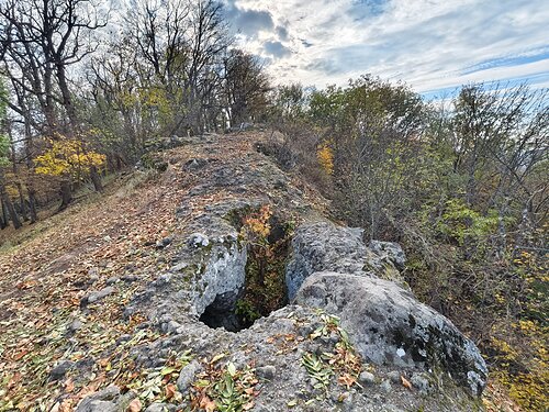
The highest point is a rock tower. The climb to this tower is a climbing activity, but there are beautiful holds and the difficulty is max II. If you are not feeling up to it, the side ridge is only 2 m lower. Below the ridge to the north is another rock tower, a prominence of about 7 m, which is considerably more difficult. The ridge is in the photo.
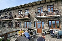
There is no chalet on the peak.
Peak is not stroller accessible.
There are no views from the peak.
There is no cable car to this peak.
No special equipment is required for this summit.
Peak is freely accessible.
Nearest peaks: Altar-ko (826 m, 0.4 km) Hangyás-bérc (863 m, 0.6 km) Csóványos (938 m, 0.7 km) Hangyás Szikla (851 m, 0.7 km) Égés-tető (833 m, 0.9 km) Varsa-tető (873 m, 1.4 km) Magosfa (931 m, 1.5 km) Nagy-Hideg-hegy (864 m, 1.7 km) Gács mountain (810 m, 2.5 km) Nagy Korom (834 m, 2.7 km) Kis Korom (831 m, 2.9 km) Korom-těrc (831 m, 3 km) Bagoly-kút (700 m, 3.3 km) Nagy-Inoc (836 m, 3.3 km)
| today | tomorrow | day after tomorrow | |
|---|---|---|---|
| Dawn: | 5:56 | 5:58 | 5:59 |
| Sunrise: | 6:28 | 6:30 | 6:32 |
| Sunset: | 16:26 | 16:25 | 16:23 |
| Dusk: | 16:58 | 16:57 | 16:56 |