


Hiking, 21 km
24.8.2026
 Německo
Logged on Vrcholovka 1x in total. Vrchol Tabakstanne was added here by Nojby.
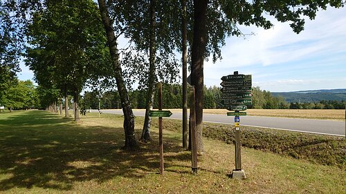
The summit is flat, with the highest point located at the intersection of the hiking trail Eisenweg and the federal road B 180 (Stollberger Strasse). Nearby, there is a nice resting place and parking for hikers.
There is no chalet on the peak.
This peak is accessible with a stroller.
Among other things, the Geyer transmitter is visible.
There is no cable car to this peak.
No special equipment is required for this summit.
Peak is freely accessible.
Nearest peaks: Wischberg (519 m, 2 km)
| today | tomorrow | day after tomorrow | |
|---|---|---|---|
| Dawn: | 7:12 | 6:14 | 6:16 |
| Sunrise: | 7:46 | 6:48 | 6:49 |
| Sunset: | 17:59 | 16:57 | 16:55 |
| Dusk: | 18:32 | 17:30 | 17:29 |
