Zelenô (2039 m a.s.l., Roháče)
Register and log summit
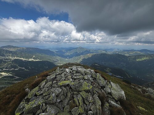

About peak Zelenô
 Slovensko
Žilinský kraj
Vrchol Zelenô was added here by Martin Matějka.
Zelenô is part of challenge: The Highest Peaks of Roháče
The name Zelenô comes from the Liptov-Orava dialect, the newer spelling is Zelené (similar to Plačlivô vs. Plačlivé). The height from Mapy.com / OpenStreetMap is apparently underestimated, the digital model from zbgis.skgeodesy.sk shows significantly more.
- Chalet/accommodation
-
There is no chalet on the peak.
- Stroller access
-
Peak is not stroller accessible.
- Views
-
There are views from the peak.
- Cable car
-
There is no cable car to this peak.
- Equipment
-
No special equipment is required for this summit.
- Accessibility
-
TANAP, the hiking trail Roháčské plesá-Tri Kopy was canceled in spring 1989 due to poor technical condition.
Nearest peaks: Tri kopy (2136 m, 0.4 km) Druhá kopa (2132 m, 0.5 km) Predná Nohavice (2025 m, 0.6 km) Tretia kopa (2133 m, 0.6 km) Hrubá kopa (2166 m, 0.8 km) Nohavica (2051 m, 0.8 km) Plačlivé (2125 m, 1.2 km) Baníkovská ihla (2096 m, 1.5 km) Baníkov (2178 m, 1.7 km) Ostrý Roháč (2088 m, 1.7 km) Príslop (2142 m, 1.9 km) Spálená (2083 m, 2 km) Smrek SV (2031 m, 2.2 km) Volovec (2064 m, 2.2 km) Rákoň / Rakoń (1879 m, 2.4 km) Smrek (2072 m, 2.4 km) Zadná Zábrať (1690 m, 2.4 km) Stredná Zábrať (1661 m, 2.6 km) Predná Zábrať (1577 m, 2.7 km) Baranec (2183 m, 3.2 km)
Routes nearby
Routes provided by SvetOutdooru.cz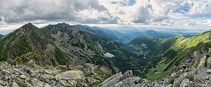
Webcams
(2082 m a.s.l., 1.2 km)
 Zuberec: Spálená
(1247 m a.s.l., 3.6 km)
 District of Tvrdošín: Brezovica: Zuberec, Roháče-Spálená - Roháče - Spálená
( 3.6 km)
 Witow › East: Kominiarski Wierch - Chochołowska Valley
(1162 m a.s.l., 5.5 km)
 Łopata
(1154 m a.s.l., 5.5 km)

Sun
| today | tomorrow | day after tomorrow | |
|---|---|---|---|
| Dawn: | 6:41 | 6:43 | 5:44 |
| Sunrise: | 7:14 | 7:15 | 6:17 |
| Sunset: | 17:36 | 17:34 | 16:32 |
| Dusk: | 18:08 | 18:07 | 17:05 |