Östliche Wetterspitze (2709 m a.s.l., Wetterstein)
Register and log summit
Weather Östliche Wetterspitze

About peak Östliche Wetterspitze
 Německo
 Rakousko
Vrchol Östliche Wetterspitze was added here by Jiří Králík and info was completed by Jan Blažej.
Help others and .
- Chalet/accommodation
- Stroller access
- Views
- Cable car
- Equipment
- Accessibility
Nearest peaks: Südliche Wetterspitze (2746 m, 0.1 km) Nördliche Wetterspitze (2746 m, 0.5 km) Wetterwandeck (2698 m, 0.5 km) Schneefernerkopf (2874 m, 1.1 km) Westliche Plattspitze (2680 m, 1.3 km) Mittlere Plattspitze (2680 m, 1.5 km) Östliche Plattspitze (2680 m, 1.6 km) Zugspitzeck (2820 m, 2 km) Westlicher Gatterlkopf (2489 m, 2.1 km) Zugspitze (2962 m, 2.6 km)
Routes nearby
(elevation gain 2000 m, )
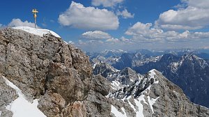 Hřebenový přechod Zugspitze – Alpspitze (Jubiläusgratweg)
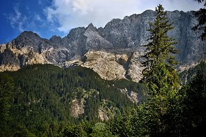 Výstup na Zugspitze feratou Höllental
(elevation gain 2800 m, 20 km)
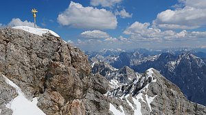 Výstup na Zugspitze oklikou přes Reintalangerhütte
(elevation gain 4200 m, 36 km)
Túra za jezery do kotle Ehrwalder Kessel (2302 m) v pohoří Wetterstein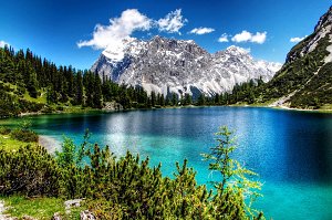 Výstup na pyramidovou horu Alpspitze v Bavorsku
(elevation gain 2500 m, 27 km)
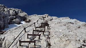 Túra soutěskou Höllentalklamm ve čtyřech ročních obdobích
(elevation gain 1200 m, 12 km)

Mountain chalets
Webcams
(2582 m a.s.l., 1.7 km)
 Gemeinde Ehrwald: Ehrwald, Zugspitze - Ehrwalder Alm
( 1.7 km)
 Gemeinde Ehrwald: Ehrwald - Almbahn
(1485 m a.s.l., 1.8 km)
 Ehrwald
(1043 m a.s.l., 1.9 km)
 Gemeinde Ehrwald: Ehrwalder Wettersteinbahnen - Racing-S-Wettersteinabfahrt-Bärengrubenabfahrt
( 1.9 km)
 Gemeinde Ehrwald: Ehrwald - Sonnenhangbahn Bergstation
( 2.3 km)
 Gemeinde Ehrwald: Ehrwalder Wettersteinbahnen - Sonnenhangbahn Bergstation
(1282 m a.s.l., 2.3 km)
 Gemeinde Ehrwald: Ehrwalder Wettersteinbahnen - Weißlähn
(1363 m a.s.l., 2.4 km)
 Gemeinde Ehrwald: Ehrwald - Weißlähn
( 2.4 km)
 Grainau › South-East: Zugspitze - Zugspitzeplat
(2933 m a.s.l., 2.6 km)
 Grainau: Bayerische Zugspitzbahn - Blick über das Höllental nach Osten
(2933 m a.s.l., 2.6 km)
 Grainau: Zugspitze Garmisch-Partenkirchen
(2933 m a.s.l., 2.6 km)
 Grainau: Bayerische Zugspitzbahn - Blick vom Gipfel nach Norden
(2933 m a.s.l., 2.6 km)
 Grainau: Wetterwarte Zugspitze - Blick über das Zugspitzplatt nach Süden
(-32768 m a.s.l., 2.6 km)
 Grainau: Seilbahn Zugspitze - Blick zum Gipfel von Westen
(2929 m a.s.l., 2.6 km)
 Grainau: Wetterwarte Zugspitze - Blick über den Gipfel nach Osten
(-32768 m a.s.l., 2.6 km)
 Gemeinde Ehrwald: Ehrwald, Zugspitze - Tiroler Zugspitzbahn Bergstation
( 2.6 km)
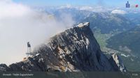 Gemeinde Ehrwald: Ehrwald, Zugspitze - Tiroler Zugspitzbahn Bergstation
( 2.6 km)
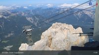 Gemeinde Ehrwald: Ehrwald, Zugspitze - Tiroler Zugspitzbahn Bergstation
( 2.6 km)
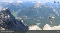 Grainau: Ehrwald, Zugspitze - Tiroler Zugspitzbahn Bergstation
( 2.6 km)
 Gemeinde Mieming: Ehrwald, Zugspitze - Feldernalm
( 2.7 km)
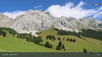 Gemeinde Mieming: Ehrwald, Zugspitze - Feldernalm
( 2.7 km)
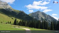 Gemeinde Mieming: Ehrwald, Zugspitze - Feldernalm
( 2.7 km)
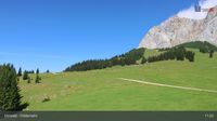 Gemeinde Ehrwald: Ehrwald, Zugspitze - Feldernalm
( 2.7 km)
 Ehrwald: Wettersteinbahnen
(1259 m a.s.l., 2.8 km)
 Gemeinde Ehrwald: Wettersteinbahnen Ehrwald
( 2.8 km)
 Gemeinde Ehrwald: Wettersteinbahnen Ehrwald
( 3.3 km)
 Gemeinde Ehrwald: Ehrwald, Zugspitzbahn Talstation
(1215 m a.s.l., 3.7 km)
 Gemeinde Ehrwald › East: Zugspitze
( 3.7 km)
 Grainau: Seilbahn Zugspitze - Weltrekord-Stütze - Blick über den Eibsee nach Norden
(1262 m a.s.l., 5.3 km)
 Ehrwald: Seebensee
(1919 m a.s.l., 5.3 km)
 Grainau: Bayerische Zugspitzbahn - Seilbahn Zugspitze - Talstation
(1022 m a.s.l., 6.4 km)
 Grainau: Eibsee-Hotel - Blick nach Südwesten zur Zugspitze
(977 m a.s.l., 6.6 km)

Sun
| today | tomorrow | day after tomorrow | |
|---|---|---|---|
| Dawn: | 6:22 | 6:23 | 6:24 |
| Sunrise: | 6:53 | 6:55 | 6:56 |
| Sunset: | 17:06 | 17:04 | 17:02 |
| Dusk: | 17:37 | 17:36 | 17:34 |