12er Nock (2516 m a.s.l., Rieserferner)
Register and log summit
Weather 12er Nock

About peak 12er Nock
 Itálie
Vrchol 12er Nock was added here by Jan Blažej.
Help others and .
- Chalet/accommodation
-
There is no chalet on the peak.
- Stroller access
-
Peak is not stroller accessible.
- Views
-
There are views from the peak.
- Cable car
-
There is no cable car to this peak.
- Equipment
-
No special equipment is required for this summit.
- Accessibility
-
Peak is freely accessible.
Nearest peaks: Schneebiger Nock / Ruthnerhorn (3358 m, 3.3 km)
Routes nearby
Typický zástupce ledovcové túry - Dreiherrenspitze
(elevation gain 2200 m, 25 km)
 Letní výstup na Westliche Simonyspitze přes Umbalkees
(elevation gain 1100 m, 15 km)
Výšlap na Zillerplatenspitze
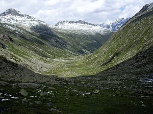
Routes provided by SvetOutdooru.cz
(elevation gain 2200 m, 25 km)
Letní výstup na Westliche Simonyspitze přes Umbalkees(elevation gain 1100 m, 15 km)
Výšlap na Zillerplatenspitze
Webcams
Rein in Taufers: Hotel Berger − Blick nach Süosten
(1600 m a.s.l., 2 km)
 Rein in Taufers: Riva Di Tures
(1599 m a.s.l., 2.1 km)
 Rasen-Antholz - Rasun-Anterselva: Antholz - Ras-Mast, Anterselva di Sopra - Antholz Obertal
( 7.2 km)
 Rasen-Antholz - Rasun-Anterselva: Antholz - Ras-Mast, Anterselva di Sopra - Antholz Obertal
( 7.2 km)
 Rasen-Antholz - Rasun-Anterselva: Antholz - Ras-Mast, Südtirol Arena Alto Adige
( 7.2 km)
 Rasen-Antholz - Rasun-Anterselva: Anterselva - Camera 2
( 7.2 km)
 Rasen-Antholz - Rasun-Anterselva › East: South Tyrol Arena
( 7.2 km)
 Rasen-Antholz - Rasun-Anterselva: Anterselva - Camera 4
( 7.2 km)
Cameras provided by windy.com
(1600 m a.s.l., 2 km)
Rein in Taufers: Riva Di Tures(1599 m a.s.l., 2.1 km)
Rasen-Antholz - Rasun-Anterselva: Antholz - Ras-Mast, Anterselva di Sopra - Antholz Obertal( 7.2 km)
Rasen-Antholz - Rasun-Anterselva: Antholz - Ras-Mast, Anterselva di Sopra - Antholz Obertal( 7.2 km)
Rasen-Antholz - Rasun-Anterselva: Antholz - Ras-Mast, Südtirol Arena Alto Adige( 7.2 km)
Rasen-Antholz - Rasun-Anterselva: Anterselva - Camera 2( 7.2 km)
Rasen-Antholz - Rasun-Anterselva › East: South Tyrol Arena( 7.2 km)
Rasen-Antholz - Rasun-Anterselva: Anterselva - Camera 4( 7.2 km)
Sun
| today | tomorrow | day after tomorrow | |
|---|---|---|---|
| Dawn: | 6:12 | 6:14 | 6:15 |
| Sunrise: | 6:44 | 6:45 | 6:46 |
| Sunset: | 17:07 | 17:05 | 17:04 |
| Dusk: | 17:38 | 17:37 | 17:35 |