


Via ferrata, 9 km
30.7.2020
Itálie
Logged on Vrcholovka 6x in total. Vrchol Punta Sud di Fanes was added here by Fíkus and info was completed by Milan "Hojší" Průžek, Martin Matějka a Jan Blažej.
German name Südliche Fanisspitze. The summit is accessed via the exposed via ferrata Via Tomaselli (D).
There is no chalet on the peak.
Peak is not stroller accessible.
To the Tofana massif and surrounding area
There is no cable car to this peak.
Via ferrata set
Peak is freely accessible.
Nearest peaks: Lagazuòi Nord (2804 m, 0.8 km) Cima Falzarego (2562 m, 1.8 km) Monte Ciaval (2911 m, 1.9 km) Col dei Bos (2559 m, 2.1 km) Il Casteletto (2656 m, 2.1 km) Monte Casale (2894 m, 2.1 km) Piccolo Lagazuoi (2778 m, 2.2 km) Torre Grande di Falzarego (2482 m, 2.3 km) Torre Piccola di Falzarego (2418 m, 2.4 km) Monte Castello (2817 m, 2.5 km) Sass de Stria (2477 m, 3.3 km)
 Výstup na třítisícovku Tofana di Rozes se psem
 Přechod horského celku Fanes v Dolomitech
 Výstup na Piza da les Diesc v Dolomitech
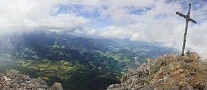 Výstup na dolomitský Croda del Becco
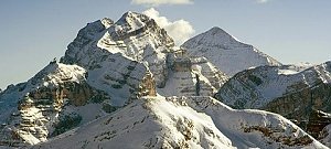
 Cernadoi: Alta Badia − Pedraces
 Passo di Falzarego › East
 Cortina d'Ampezzo: Lagazuoi − Tofane
 Cortina d'Ampezzo › South-East
 Cortina d'Ampezzo: Col Gallina
 Pocol: Tofana − Rifugio Dibona
 Cortina d'Ampezzo
 Cortina d'Ampezzo: Pomedes
 Cortina d'Ampezzo: Cinque Torri
 Cortina d'Ampezzo: Cortina d’Ampezzo, 5 Torri
 Colle Santa Lucia › North-West: Rifugio Averau
 Colle: Averau

| today | tomorrow | day after tomorrow | |
|---|---|---|---|
| Dawn: | 6:33 | 6:34 | 6:35 |
| Sunrise: | 7:05 | 7:06 | 7:08 |
| Sunset: | 16:46 | 16:44 | 16:43 |
| Dusk: | 17:18 | 17:17 | 17:16 |