


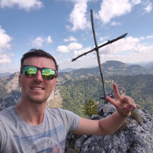

Hiking
ne, 24.5.2026, 10:17
 Rakousko
Logged on Vrcholovka 1x in total. Vrchol Große Burgwand was added here by Jiří Králík and info was completed by Jiří Králík.
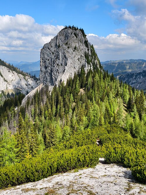
This is a beautiful climbing peak UIAA-II alpine style. I mapped the entire Gr.Burgwand, marked the climbing line, and found a suitable descent. It is undoubtedly the most interesting endeavor in the Windberggruppe.
For those interested, I can provide materials for route orientation, a sketch of the line, and a sketch of a safe descent for a small tip, as it took a lot of effort and time to find the route in the unknown, which included drone mapping and a few unsuccessful ascent attempts. It is possible that I am the first Czech to summit this peak. :)
(Austrian websites have sparse and mainly incorrect information and wrong photos from the simple Kleiner Burgwand, so be careful, this is no ordinary hiking with poles, but a dangerous ascent).
Information provided by Jiří Králík, more info can be found on FB @jiri.kralik.91
There is no chalet on the peak.
Peak is not stroller accessible.
There are views from the peak.
There is no cable car to this peak.
A helmet is suitable, climbing gear won't be very useful here. There are no bolts. There are no places for anchoring or setting up slings. The terrain is crumbling.
Peak is freely accessible.
Nearest peaks: Vorder Burgwand (1478 m, 0.4 km) Burgwandalm (1577 m, 0.6 km) Kleine Burgwand (1787 m, 1.2 km) Hintere Burgwand (1782 m, 1.3 km) Kleine Mitterbergwand (1863 m, 1.3 km) Kleiner Mitterridge (1830 m, 1.3 km) Mitterturm (1829 m, 1.3 km) Nieder Gamskircherl (1654 m, 1.4 km) Gross Mitterridge (1840 m, 1.5 km) Hohes Gamskircherl (1752 m, 1.5 km) Große Goldgrubenhöhe (1425 m, 1.6 km) Kleine Goldgrubenhöhe (1227 m, 1.7 km) Langseiten (1785 m, 1.8 km) Schusterstuhl (1875 m, 1.8 km) Eisenkogel (1513 m, 1.9 km) Geierturm (1674 m, 2.1 km) Geierwandln (1724 m, 2.2 km) Kleiner Amaißbichl (1751 m, 2.2 km) Mooskogel (1788 m, 2.3 km) Grassgrabenhöhe (1474 m, 2.4 km) Windberg (1903 m, 2.4 km) Gläserkogel (1819 m, 2.5 km) Hinterer Windberg (1874 m, 2.5 km) Glatzeter Kogel (1594 m, 2.6 km) Kramerin (1833 m, 2.6 km) Hoher Klapf (1865 m, 2.7 km) Schauerwand (1819 m, 2.8 km) Hoher Knopp (1864 m, 3 km) Nieder Knopp (1830 m, 3 km) Niederer Klapf (1785 m, 3 km) Schauerkogel (1788 m, 3 km) Karlwand (1811 m, 3.1 km) Kleiner Karlwand (1793 m, 3.2 km) Brunnkogel (1798 m, 3.3 km) Brunnwand (1803 m, 3.3 km) Karleck (1768 m, 3.3 km) Lettingkogel (1393 m, 3.3 km) Mittenkogel (1778 m, 3.3 km)
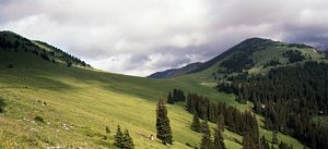 Přechod Heukuppe přes ferraty Alpevereinsteig a Bismarcksteig
| today | tomorrow | day after tomorrow | |
|---|---|---|---|
| Dawn: | 6:09 | 6:11 | 6:12 |
| Sunrise: | 6:41 | 6:43 | 6:44 |
| Sunset: | 16:40 | 16:38 | 16:37 |
| Dusk: | 17:12 | 17:11 | 17:09 |