



Hiking
so, 23.5.2026, 13:23
 Rakousko
Logged on Vrcholovka 1x in total. Vrchol Schönhaltereck SZ was added here by Jiří Králík and info was completed by Jiří Králík.
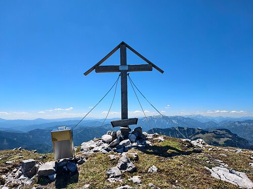
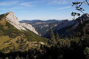
Unmarked trail. Summit cross. Views.
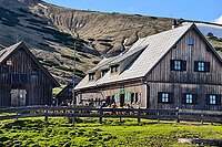
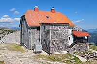
There is no chalet on the peak.
Peak is not stroller accessible.
There are views from the peak.
There is no cable car to this peak.
No special equipment is required for this summit.
Peak is freely accessible.
Nearest peaks: Schönhaltereck (1860 m, 0.1 km) Nassenschönhaltereck (1835 m, 0.3 km) Nieder Schönhaltereck (1831 m, 0.4 km) Hoher Knopp (1864 m, 0.5 km) Nasenknopp (1832 m, 0.6 km) Nieder Knopp (1830 m, 0.7 km) Öde Kirche (1644 m, 0.7 km) Kramerin (1833 m, 0.8 km) Gläserkogel (1819 m, 0.9 km) Gläserkogel (1746 m, 0.9 km) Hirscheck (1668 m, 1.1 km) Karlwand (1811 m, 1.1 km) Kleiner Karlwand (1793 m, 1.1 km) Hinterer Windberg (1874 m, 1.4 km) Karleck (1768 m, 1.4 km) Kitzberg (1581 m, 1.4 km) Nasendonner (1623 m, 1.7 km) Windberg (1903 m, 1.9 km) Brunnwand (1803 m, 2 km) Hoher Klapf (1865 m, 2 km) Donnerwand (1799 m, 2.1 km) Hohes Gamskircherl (1752 m, 2.1 km) Kleine Mitterbergwand (1863 m, 2.1 km) Mitterturm (1829 m, 2.1 km) Gross Mitterridge (1840 m, 2.2 km) Kleiner Mitterridge (1830 m, 2.2 km) Niederer Klapf (1785 m, 2.3 km) Schusterstuhl (1875 m, 2.3 km) Schwarzkogel (1383 m, 2.3 km) Grünkogel (1813 m, 2.5 km) Nieder Gamskircherl (1654 m, 2.5 km) Kleines Waxenegg (1682 m, 2.6 km) Kuhkogel (1047 m, 2.6 km) Rauhenstein (1770 m, 2.6 km) Draxlerkogel (1354 m, 2.7 km)
 Výstup na vrcholy Göller a Gippel
| today | tomorrow | day after tomorrow | |
|---|---|---|---|
| Dawn: | 6:15 | 6:16 | 6:18 |
| Sunrise: | 6:48 | 6:49 | 6:51 |
| Sunset: | 16:34 | 16:33 | 16:31 |
| Dusk: | 17:07 | 17:05 | 17:04 |