




Hiking, 11 km
9.5.2026
 Německo
Logged on Vrcholovka 26x in total. Vrchol Steinbühler Gesenke was added here by Vladimír Grančay and info was completed by Martin Matějka, Profesorskey - Jan Bratt a Jiří Králík.
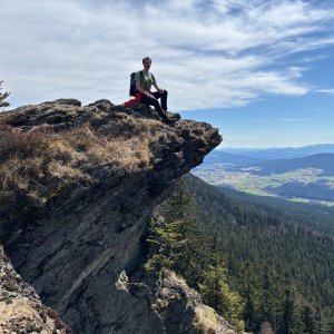
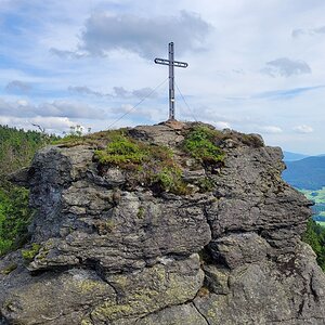
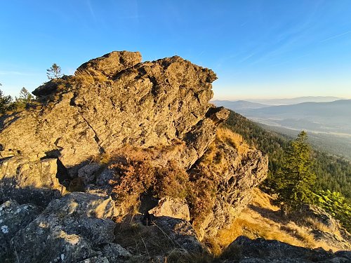
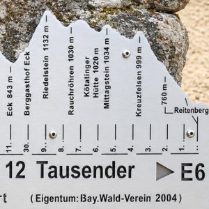
Personally, I consider this part of the hiking trail "Goldsteig" to be the most beautiful, but everyone must draw their own conclusion after conquering those thirty splendid kilometers through the 12 thousanders of the German Šumava. Steinbühler Gesenke is a sloping stone field that invites climbing with its character. For everyone else, there is the mentioned trail that runs along the edge of the rock outcrop. Thanks to the open view and relatively high altitude, you will be greeted with a view to the south, into the Zellertal valley with its hundred shades of fields and the rolling landscape of the Bavarian Forest. If you want to have a snack on Goldsteig, I recommend it at this spot. The highest point is a bit hidden off the trail (it's the one in the photo) and requires the use of hands to reach. Other viewpoints on this rock are accessible even for a dog.
There is no chalet on the peak.
Peak is not stroller accessible.
There are views from the peak.
There is no cable car to this peak.
No special equipment is required for this summit.
Peak is freely accessible.
Nearest peaks: Steinbühler Gesenke Z (1041 m, 0.1 km) Steinbühler Gesenke V (1041 m, 0.2 km) Steinbühler Gesenke Z2 (1028 m, 0.3 km) Rauchröhren (1042 m, 0.5 km) Kaiterstein (1026 m, 0.6 km) Kaitersberg Z (1054 m, 0.8 km) Kaitersfelsen (1052 m, 0.8 km) Kaitersberg SZ (1055 m, 0.9 km) Steinbühler Gesenke S (901 m, 0.9 km) Bockshornstein (865 m, 1 km) Kaitersberg (1069 m, 1 km) Mittagstein (1034 m, 1 km) Steinbühler Gesenke S2 (900 m, 1 km) Hüttenstein (980 m, 1.1 km) Mittagstein Z1 (1013 m, 1.3 km) Großer Riedelstein (1132 m, 1.5 km) Mittagstein Z2 (993 m, 1.6 km) Eckerriegel (1050 m, 1.8 km) Kleiner Riedelstein (1042 m, 1.9 km) Kreuzfelsen V2 (962 m, 2 km) Großer Riedelstein S (804 m, 2.2 km) Kreuzfelsen V (983 m, 2.2 km) Above the Chapel (913 m, 2.5 km)
| today | tomorrow | day after tomorrow | |
|---|---|---|---|
| Dawn: | 6:19 | 6:21 | 6:22 |
| Sunrise: | 6:52 | 6:54 | 6:55 |
| Sunset: | 16:51 | 16:49 | 16:47 |
| Dusk: | 17:24 | 17:22 | 17:20 |