Omeshorn (2557 m a.s.l., Lechquellengebirge)
Register and log summit
Weather Omeshorn

About peak Omeshorn
 Rakousko
Vrchol Omeshorn was added here by Jan Blažej and info was completed by Jan Blažej.
Help others and .
- Chalet/accommodation
-
There is no chalet on the peak.
- Stroller access
-
Peak is not stroller accessible.
- Views
-
There are views from the peak.
- Cable car
-
There is no cable car to this peak.
- Equipment
-
No special equipment is required for this summit.
- Accessibility
-
Peak is freely accessible.
Nearest peaks: Madlochspitze (2545 m, 0.8 km) Stierlochkopf (2354 m, 1.4 km) Kleine Wildgrubenspitze (2625 m, 1.6 km) Große Wildgrubenspitze (2753 m, 2.3 km) Roggalspitze (2673 m, 2.3 km) Vordere Hasenfluh (2534 m, 2.8 km)
Routes nearby
Routes provided by SvetOutdooru.cz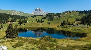
Mountain chalets

Webcams
(2431 m a.s.l., 1.1 km)
 Gemeinde Lech: Zürs am Arlberg, Arlberg - Seekopf
( 1.6 km)
 Gemeinde Lech: Zürsersee chairlift mountain station - Zürsersee Sesselbahn
(2185 m a.s.l., 1.7 km)
 Zug › South: Österreich: Madloch
(1501 m a.s.l., 2.2 km)
 Gemeinde Lech: Schmelzhof - ****Hotel - Lech am Arlberg
(1463 m a.s.l., 2.3 km)
 Wald am Arlberg: Lech am Arlberg, Arlberg - Zug
( 2.3 km)
 Gemeinde Lech › North-East: Hotel Schmelzhof - Lech am Arlberg - Lech am Arlberg
( 2.4 km)
 Gemeinde Lech: Muggengrat Sesselbahn, Bergstation
(2420 m a.s.l., 2.4 km)
 Gemeinde Lech › North-East: Cafe Gotthard - Backstube - Lech am Arlberg
( 2.5 km)
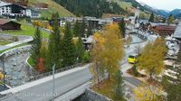 Gemeinde Lech: Lech am Arlberg - Sporthaus Strolz
(1442 m a.s.l., 2.7 km)
 Gemeinde Lech: Lech am Arlberg, Arlberg - Flühen
( 2.8 km)
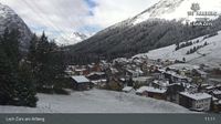 St. Anton am Arlberg: Schlegelkopf-Areal - Chalet Anna Maria, Maria, Lech am Arlberg
(1440 m a.s.l., 2.8 km)
 Gemeinde Lech: Chalet Anna Maria - Lech am Arlberg
( 2.8 km)
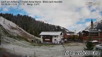 Zürs am Arlberg: Zürs − in Richtung Süden (im Hintergrund der Flexenpaß und die Albona oberhalb von Stuben)
(1712 m a.s.l., 2.9 km)
 Lech › East: Hexenboden Sesselbahn, Talstation
(1709 m a.s.l., 3 km)
 Gemeinde Lech › South-east: Ski Zürs - Zürs
( 3 km)
 Gemeinde Lech: Sporthotel Lorünser - Zürs
( 3.2 km)
 Lech › South-East: Zürs - Österreich: Skigebiet Zürs am Arlberg - Blick in Richtung Flexenbahn mit Trittkopf und Ochskopf
(1719 m a.s.l., 3.3 km)
 Lech: Trittkopfbahn, Talstation - Zürs - Trittkopf
(1722 m a.s.l., 3.3 km)
 Gemeinde Lech: Mohnenfluh - Juppenspitze - Omeshorn - Braunarlspitze - Karhorn - Wösterspitzen - Zürs - Widderstein - Trittkopf - Valluga - Rappenspitze
(2078 m a.s.l., 3.3 km)
 Gemeinde Lech: Rüfikopf Seilbahn 2 Bergstation
( 3.4 km)
 Gemeinde Lech: Lech am Arlberg, Arlberg - Oberlech
( 3.4 km)
 Gemeinde Klosterle › North-West: Lechquellenrunde - Ravensburger Hütte: Lechquellenrunde - Ravensburger Hütte
( 3.4 km)
 Gemeinde Lech › South: Ravensburger Hütte - Spullersee - Lechquellen Mountains
( 3.4 km)
 St. Anton am Arlberg: Pension Bergland
(1559 m a.s.l., 3.7 km)
 Gemeinde Lech: Pension Berger Oberlech
(1633 m a.s.l., 3.7 km)
 Gemeinde Lech: Oberlech - Rüfikopf Bergstation - Großer Widderstein - Kleiner Widderstein
(1676 m a.s.l., 3.7 km)
 Gemeinde Lech: Hotel Mohnenfluh
(1711 m a.s.l., 4 km)
 Gemeinde Lech: Hotel Mohnenfluh - Terrasse - Oberlech am Arlberg
( 4 km)
 Gemeinde Lech › West: Hotel Mohnenfluh
(1711 m a.s.l., 4 km)
 Gemeinde Lech: Hotel Mohnenfluh
( 4 km)
 Gemeinde Lech: Hotel Mohnenfluh - Oberlech am Arlberg
(1717 m a.s.l., 4.1 km)
 Gemeinde Lech: Trittalp Sesselbahn, Bergstation - Trittalpe
(2143 m a.s.l., 4.2 km)
 Gemeinde Lech
( 4.2 km)
 Gemeinde Lech: Zürs am Arlberg, Arlberg - Trittkopf
( 4.9 km)
 Gemeinde Lech: Lech am Arlberg - Blick nach Südwest ins Zugertal
(1919 m a.s.l., 5 km)
 Stuben: am Arlberg - Flexengalerie - Blick nach Südwesten
( 5 km)
 Gemeinde Lech
(1496 m a.s.l., 5.1 km)
 Gemeinde Lech: Flexenbahn, Bergstation / Trittkopfbahn, Mittelstation
(2198 m a.s.l., 5.3 km)
 Gemeinde Klosterle: Spullersee
(1826 m a.s.l., 5.3 km)
 Stuben › North-East: Vorarlberg, Österreich: Übungslift - Am Arlberg
(1411 m a.s.l., 5.6 km)
 Stuben: Albona
(1406 m a.s.l., 5.6 km)
 Stuben: Stuben, Arlberg
(1388 m a.s.l., 5.7 km)
 Stuben › West: Vorarlberg, Österreich: Suitenhotel-Alpin - am Arlberg
(1445 m a.s.l., 5.8 km)
Sun
| today | tomorrow | day after tomorrow | |
|---|---|---|---|
| Dawn: | 7:18 | 7:19 | 6:20 |
| Sunrise: | 7:49 | 7:50 | 6:52 |
| Sunset: | 18:18 | 18:16 | 17:14 |
| Dusk: | 18:49 | 18:47 | 17:46 |