Hiking, 26 km
13.10.2026
 Česko
Teplice (Ústecký kraj)
Logged on Vrcholovka 70x in total. Vrchol Kloč (Pařez) was added here by Martin Matějka and info was completed by Martin Matějka, Bouřka, PetanOP a otaznick.
Kloč (Pařez) is part of challenges: Nejhory Středohoří, Nejhory Ústecka, The Most Prominent Mountains of the Czech Republic, Ultrakopce
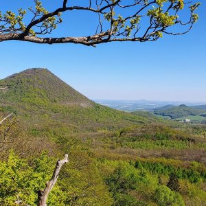
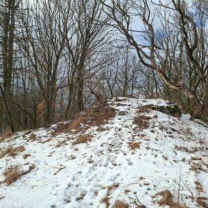
In German Klotzberg (der Klotz = block), formerly Pařez, the third highest peak of the Czech Central Mountains. It was formed by the exposure of a neovolcanic laccolith made of sodalite trachyte. Slope processes and sheet-like rock disintegration are evident on its slopes. It is covered with deciduous to mixed forests.
The mountain has had several names in the past. The name Pařez was used on state maps issued between 1968-1995, on military topographic maps, and in the Geographic Lexicon of the Czech Republic: Mountains and Lowlands from 2006. The name Kloc appeared on a state map from 1952 and in a tourist guide to Czechoslovakia from 1984.
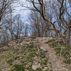
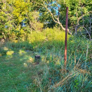
There is no marked hiking trail leading to the hill; only a blue-marked path from Lukov to Milešovka passes through the saddle between the peak and Kleč. A wide unmarked forest road branches off from it to the summit. At the top, there is a stone pyramid, likely a remnant of the base of a triangulation point.
/taken from Wikipedia/
There is no chalet on the peak.
Peak is not stroller accessible.
There are no views from the peak.
There is no cable car to this peak.
No special equipment is required for this summit.
Peak is freely accessible.
Nearest peaks: U studánky (569 m, 0.5 km) Kleč (721 m, 0.6 km) Kostomlaty (562 m, 0.9 km) Josef's Stone (494 m, 1 km) Štěpánovská hora (651 m, 1 km) Kamenný vrch (675 m, 1.2 km) Kamenný vrch V (671 m, 1.3 km) Bukový vrch J (686 m, 1.4 km) Chlomek (483 m, 1.4 km) Stříbrný vrch (614 m, 1.4 km) Mravenčí vrch (661 m, 1.5 km) Bukový vrch (679 m, 1.6 km) Mravenčí vrch J (657 m, 1.7 km) Mravenčí vrch JZ (591 m, 1.7 km) Mravenčí vrch V (657 m, 1.7 km) Hlaváč (679 m, 1.9 km) Kostomlatský vrch (557 m, 1.9 km) Kostomlatský vrch JV (557 m, 1.9 km) Velká skála (618 m, 1.9 km) Kostomlatský vrch V (544 m, 2 km) Lukov (570 m, 2 km) Mrtvý vrch (441 m, 2 km) Kateřina (667 m, 2.1 km) Roudný (455 m, 2.1 km) Kostomlatský vrch S (472 m, 2.4 km) Zvon (664 m, 2.4 km) Vinská hora (441 m, 2.5 km) Malá Francka (582 m, 2.6 km) Zvon S (610 m, 2.6 km) Táhlina S1 (558 m, 2.7 km) Táhlina S2 (562 m, 2.7 km) Keller's Hill J (433 m, 2.8 km) Keller's Hill (441 m, 2.9 km) Kozí vrch (521 m, 2.9 km) Nad Okružní cestou (558 m, 2.9 km) Táhlina (670 m, 3.1 km) Kovářka SV (519 m, 3.2 km) Kovářka (530 m, 3.3 km) Táhlina JZ (544 m, 3.3 km) Táhlina JZ1 (540 m, 3.3 km) Táhlina JZ3 (537 m, 3.3 km) Velký obr (603 m, 3.3 km) Střední vrch (505 m, 3.4 km) Teplický vrch (444 m, 3.4 km) Dlouhý vrch (525 m, 3.5 km)
| today | tomorrow | day after tomorrow | |
|---|---|---|---|
| Dawn: | 7:06 | 7:08 | 6:10 |
| Sunrise: | 7:40 | 7:42 | 6:43 |
| Sunset: | 17:57 | 17:55 | 16:53 |
| Dusk: | 18:30 | 18:28 | 17:26 |