


Hiking, 24 km
25.1.2025
 Albánie
Logged on Vrcholovka 1x in total. Vrchol Maja Kollovoçkës was added here by Jan and info was completed by Martin Matějka.
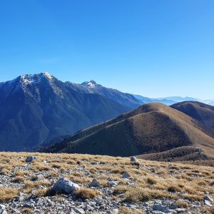
The summit is flat and rocky, offering an amazing view in all directions. There is no marked path to the top, and the trail does not exist on mapy.cz. Even a physically fit hiker will need four hours to reach the summit. The route is slowed down by sections of weathered limestone, which creates sharp edges and significantly hinders walking. There are no exposed areas along the way.
There is no chalet on the peak.
Peak is not stroller accessible.
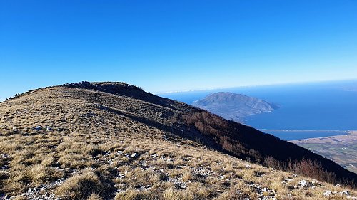
From the summit, you can see the Vlorë Bay and the nearby towns as if they were in the palm of your hand. You gaze down at the Karaburun Peninsula from above. The views are stunning.
There is no cable car to this peak.
No special equipment is required for this summit.
Peak is freely accessible.
| today | tomorrow | day after tomorrow | |
|---|---|---|---|
| Dawn: | 5:40 | 5:41 | 5:42 |
| Sunrise: | 6:08 | 6:09 | 6:10 |
| Sunset: | 16:43 | 16:42 | 16:41 |
| Dusk: | 17:11 | 17:10 | 17:09 |
