Mali i Dajtit (1613 m a.s.l., Skanderbeg Mountains)
Register and log summit

About peak Mali i Dajtit
 Albánie
Logged on Vrcholovka 3x in total. Vrchol Mali i Dajtit was added here by Jan and info was completed by Martin Matějka.
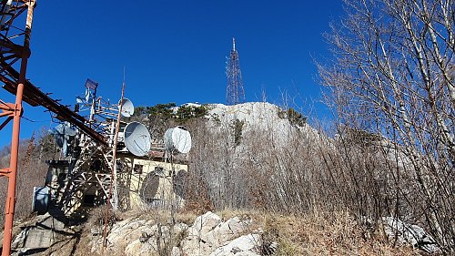
You cannot reach the summit directly. It is a guarded area secured by a fence. The highest accessible path leads about 50 meters below the summit.
- Chalet/accommodation
-
There is no chalet on the peak.
- Stroller access
-
Peak is not stroller accessible.
- Views
-
From the ridge south of the summit, where there is a marked hiking trail, the views are amazing.
- Cable car
-
The Dajti Express cable car goes to the Dajti ridge. However, the summit is still almost 4 km and 500 meters of elevation away.
- Equipment
-
No special equipment is required for this summit.
- Accessibility
-
Restricted area
Nearest peaks: Maja e Tujanit (1524 m, 1.4 km)
Sun
| today | tomorrow | day after tomorrow | |
|---|---|---|---|
| Dawn: | 5:39 | 5:40 | 5:42 |
| Sunrise: | 6:08 | 6:09 | 6:10 |
| Sunset: | 16:39 | 16:38 | 16:37 |
| Dusk: | 17:08 | 17:07 | 17:05 |