




Hiking, 16 km
23.10.2026
 Česko
 Polsko
Rychnov nad Kněžnou (Královéhradecký kraj)
Logged on Vrcholovka 202x in total. Peak information here was completed by KaMo, Pája, NadWei a Martin Matějka.
Šerlich is part of challenges: Koruna Sudet, Nejhory Kladska, The Highest Mountains of Hradec Králové Region, The Highest Peaks of Orlické hory, Thousanders of the Czech Republic, Via Czechia Severní stezka
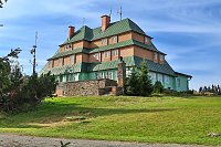
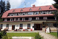
Šerlich is a mountain in the Orlické Mountains (height 1027 m) and a popular hiking destination. Jiráskova cesta, the main ridge trail of the Orlické Mountains, runs over the summit. On the southeastern slope stands the Masarykova chata from 1925, designed by architect Bohuslav Fuchs (his first completed work).
Masarykova
This peak is accessible with a stroller.
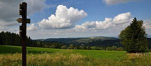
There are views from the peak.
on the Polish side (Zieleniec) is a ski area
No special equipment is required for this summit.
Peak is freely accessible.
Nearest peaks: Šerlich JV (1019 m, 0.5 km) Esplanada (889 m, 0.9 km) Kamenný vrch (1037 m, 1.6 km) Nad Bukačkou (1035 m, 1.6 km) Sedloňovský vrch (1050 m, 1.9 km) Malá Deštná (1090 m, 2 km) Vrchmezí (1084 m, 2.9 km) Velká Deštná (1116 m, 3.4 km)
 Zieleniec
 Zieleniec: Winterpol NOWOŚĆ
 Zieleniec: SKI Arena - Winterpol
 Destne v Orlickych horach
 Zieleniec: Winterpol
 Šerlich › North: Královéhradecký
 Destne v Orlickych horach
 Jedlova v Orlickych horach: Deštné v Orlických horách - Marta I
 Destne v Orlickych horach
 Sedlonov › West: Polom

| today | tomorrow | day after tomorrow | |
|---|---|---|---|
| Dawn: | 5:59 | 6:01 | 6:03 |
| Sunrise: | 6:33 | 6:34 | 6:36 |
| Sunset: | 16:43 | 16:41 | 16:40 |
| Dusk: | 17:17 | 17:15 | 17:13 |
















