Tour d'Ai (2331 m a.s.l., Bernese Alps)
Register and log summit
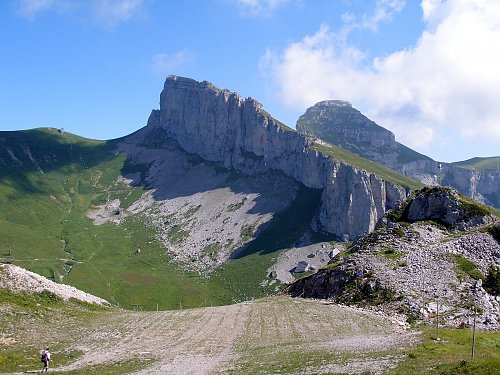

About peak Tour d'Ai
 Švýcarsko
Vrchol Tour d'Ai was added here by Milan "Hojší" Průžek.
Elevation gain: about 1000 m
Ascent time: 2.5 hours
Risk: just below the summit, the path was at times in very steep terrain.
Ascent:
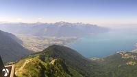
We park as high as possible in the mountain resort of Leysin, about 300 meters past the large paid parking lot. We can also take the cable car, but we prefer to save francs and walk up the slopes. When we get tired of it, we reach the level of a luxurious glass rotating restaurant, which we could have reached by cable car if I hadn't advised us to walk. We continue right around the lake (Lac d'Ai) and ascend the hiking trail to the first of two prominent rocky teeth. The second tooth (Tour Mayen) can also be climbed, roughly equally difficult. Beautiful view of the lake (Lac Leman), the lower part of the trail is a bit boring.
Leysin - Lac d'Ai: 1 hour (cepr)
Lac d'Ai - summit: 1 - 1.5 hours (cepr)
There is a beautiful, perfectly made via ferrata leading to Tour d'Ai, I recommend it. However, it is good to have the appropriate via ferrata equipment, as the ferrata leads at times even over small overhangs! You can walk again to the lake Lac d'Ai. There is already a sign for the ferrata, but it is better not to go in the rubble directly under the wall, but to ascend from the left along the southwest wall on the grass under the cable car. Reach the end of the slope to the saddle, then follow the path to the wall. A white sign is clearly visible at the start of the ferrata.
- Chalet/accommodation
-
There is no chalet on the peak.
- Stroller access
-
Peak is not stroller accessible.
- Views
-
There are views from the peak.
- Cable car
-
There is no cable car to this peak.
- Equipment
-
No special equipment is required for this summit.
- Accessibility
-
Peak is freely accessible.
Routes nearby
(elevation gain 1700 m, 12 km)
 Přechod dálkové trasy GR5 přes francouzské Alpy
(elevation gain 30000 m, 620 km)
Webcams
( 0.8 km)
 Leysin: Kuklos
( 1.4 km)
 Feydey: Chalet Sybil, CH-1854 Leysin : vue en direction de l'est
(1086 m a.s.l., 2.6 km)
 Leysin: Chalet Sybil, 1854 − vue en direction du sud-ouest
(1086 m a.s.l., 2.7 km)
 Leysin: Tobogganing Park
( 3.7 km)
 La Forclaz: Vue de Leysin depuis
(1741 m a.s.l., 5.7 km)
 Aigle
(429 m a.s.l., 6.4 km)
 Veytaux: Rochers de Naye
( 6.9 km)
Sun
| today | tomorrow | day after tomorrow | |
|---|---|---|---|
| Dawn: | 6:37 | 6:39 | 6:40 |
| Sunrise: | 7:09 | 7:10 | 7:11 |
| Sunset: | 17:22 | 17:20 | 17:19 |
| Dusk: | 17:53 | 17:52 | 17:50 |