




Hiking, 23 km
17.2.2024 to 18.2.2024
 Německo
 Rakousko
Logged on Vrcholovka 3x in total. Vrchol Schneibstein was added here by Milan "Hojší" Průžek.
Schneibstein has two summit crosses and is considered the easiest 2000m peak in the Berchtesgaden Alps, which can be ascended without major difficulties. Originally a ski tour, it is also very rewarding in summer with a picturesque circular route.
The vast summit plateau of Schneibstein offers views in all their glory. But the rest of the trail, through karst terrain and around the idyllic Seeleinsee lake, is very diverse and will leave you with lasting impressions. Experienced mountain hikers should have no problems with this tour through the Hagen mountain range.
However, the ascents to the summit are not just a stone's throw away without the support of a cable car and will take some time. The fastest way to get from Hinterbrand to Schneibstein is via the middle station of the Mitterkaseralm cable car and the Stahlhaus, which is open year-round. If you take the cable car to Jenner and start your tour from there, you can shorten your ascent time by 1.5 hours. But regardless of which direction and how you reach the summit: The hike to Schneibstein offers countless beautiful views of the rugged Berchtesgaden mountains even during the ascent.
Ascent:
You leave the parking lot in Hinterbrand and follow the signs on a wide forest path to Mitterkaseralm. After a short while, the first view of Watzmann opens up through the trees. After a good quarter of an hour, the trail veers left towards Mitterkaseralm. Stairs lead us up a grassy slope, where the path now winds steeply uphill. After another 20 minutes, we reach a flat section that leads us to the forest.
Upon reaching the forest, the incline of our path increases significantly again, and we quickly ascend among the trees until we encounter a forest road. When you reach the forest road, turn left and continue along it with a gentle ascent to the beautifully situated Mitterkaseralm, which you will reach after 1.25 hours of walking. Another path is clearly visible on the alpine pasture. We follow the paved road towards Jenner. However, after a few minutes, you turn left and continue towards Stahlhaus.
Now we embark on a leisurely hike to the saddle below the summit of Jenner. On our left, the impressive rock face of Hoher Brett accompanies us during the ascent. A good quarter of an hour after crossing Mitterkaseralm, we reach the saddle. Here we turn left and walk through a pine alley for 10 minutes to another junction. From there, we go a few meters downhill towards the Schneibsteinhaus hut, which is already visible. Schneibsteinhaus is not directly on the trail, and you will reach it with a small detour.
The direct path to Stahlhaus leads above Schneibsteinhaus, and 20 minutes after passing the last junction, you will arrive at the Carl-von-Stahl-Haus, located at Torrener Joch. The border between Bavaria and Salzburg runs directly through the pass. At the hut, you turn right and continue along the ridge covered with pines towards Schneibstein. On your left, you look down into the Bluntau valley on the Salzburg side, where the path from Golling leads up to Stahlhaus.
Our path soon meets the first steep stairs, whose worn rocks can be unpleasantly slippery when wet. After a longer Schrofens passage, the terrain gradually recedes again, and we enter karst terrain. After this short break, the markings lead us over boulders onto the grassy slope of Schneibstein. We cross a small ravine over light stones and finally ascend a rocky path along the grassy slope in switchbacks.
Shortly before the summit, you will encounter a rugged ramp that finally brings us to the flat and spacious summit plateau of Schneibstein with two summit crosses. Once we find ourselves at the highest point, we can admire the close-up view of the wall of Hoher Brett and Hoher Göll. In the distance, the glaciated Dachstein peeks out. Across the karst high plateau of the Hagen mountains, the view finally unfolds towards Hochkönig and Steinernes Meer with Großer Hundstod on Watzmann and Hochkalter.
If you are lucky, you may spot many chamois and marmots. If you set out early in the morning, you might also encounter rare ibexes…
Refreshment stops:
Mitterkaseralm (1534 m), Tel. +49 (0)8652/5100. Open from early May to late October, Wednesday to Sunday from 10:00 to 18:00. From December to April, it is open for skiing. Closed on Mondays and Tuesdays.
Refreshments and overnight stay:
Schneibsteinhaus (1670 m), tel. +49 (0)8652/2596. Open from early May to late October.
Carl-von-Stahl-Haus (1736 m), OeAV Salzburg section, tel. +49 (0)8652/6559922. Open daily, closed on December 24.
Height Distance Total Checkpoint
1130 m a.s.l. - 1534 m a.s.l. + 1:15 1:15 Mitterkaseralm
1534 m - 1736 m a.s.l. + 0:45 2:00 Carl-von-Stahl-Haus
1736 m - 2276 m + 1:45 3:45 Schneibstein
Below the summit
Peak is not stroller accessible.
There are views from the peak.
Nearby
No special equipment is required for this summit.
Peak is freely accessible.
Nearest peaks: Reinersberg (2171 m, 0.9 km) Windschartenkopf (2211 m, 1.6 km) Pfaffenkegel (1850 m, 2 km) Fagstein (2164 m, 2.5 km) Hohes Brett (2340 m, 2.5 km) Großer Archenkopf (2391 m, 2.9 km)
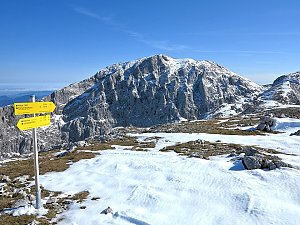 Túra na Hoher Göll přes Orlí hnízdo
 Túra z Jenneru na Schneibstein a k jezírku Seeleinsee
Lehká túra k nejvyššímu německému vodopádu s plavbou přes Königssee
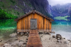 Trek Berchtesgadenskými Alpami
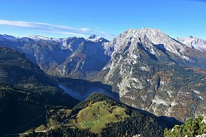 Výstup na Grünstein procházkou i sportovním klettersteigem
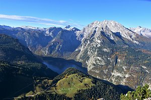
 Berchtesgaden: Jennerbahn
 Berchtesgaden Alps: Berchtesgaden - FlyingCam
 Konigssee: Hagengebirge - Funtenseetauern
 Konigssee: Hohes Brett
 Schönau am Königsee: Jenneralm - Jennerbahn
 Schönau am Königsee: Jennerbahn
 Schonau am Konigssee: Jenner Bergstation
 Schonau am Konigssee: Jenner Bergstation
 Berchtesgaden: Kehlstein
 Grafl: Windbeutelbaron - Obersalzberg - Berchtesgaden - Blick zum Watzmann
 Berchtesgaden › South-West

| today | tomorrow | day after tomorrow | |
|---|---|---|---|
| Dawn: | 7:08 | 6:09 | 6:11 |
| Sunrise: | 7:39 | 6:41 | 6:42 |
| Sunset: | 18:04 | 17:02 | 17:00 |
| Dusk: | 18:35 | 17:34 | 17:32 |


