



Hiking
po, 11.3.2024, 11:30
 Česko
Most (Ústecký kraj)
Logged on Vrcholovka 1x in total. Spočinek Obětní kámen was added here by Tor and info was completed by Tor.
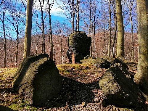
The first find of its kind in the Ore Mountains - a sacrificial site used from prehistoric times to the Middle Ages. A three-meter granite formation visible from afar, where shards of a Štítary-type vessel from 1800 BC were found. Additionally, fragments of two jugs from the 14th and 15th centuries. Nearby is a partially damaged circular rampart of unknown (possibly Celtic) origin, with a stone in its center. To the east lies the so-called Swedish Fortifications - remnants of the winter quarters of the Swedish army from 1644. The rampart and two ditches are preserved to protect the canvas dwellings for 20 to 30 soldiers. On the way west, a small plateau features the Red Cross in memory of two children who froze to death here in a snowstorm in 1868.
There is no chalet on the peak.
Peak is not stroller accessible.
There are views from the peak.
There is no cable car to this peak.
No special equipment is required for this summit.
Peak is freely accessible.
Nearest peaks: Alberk (384 m, 0.7 km) Josefinina skála (589 m, 1 km) Černický vrch (575 m, 1.1 km) Jánský vrch (751 m, 1.4 km) Tobolka (778 m, 1.9 km) Jezeří (707 m, 2.1 km) Kapucín (743 m, 2.2 km) Kapucín SV (712 m, 2.5 km) Čihadlo (792 m, 2.8 km)
| today | tomorrow | day after tomorrow | |
|---|---|---|---|
| Dawn: | 6:21 | 6:22 | 6:24 |
| Sunrise: | 6:55 | 6:57 | 6:58 |
| Sunset: | 16:43 | 16:42 | 16:40 |
| Dusk: | 17:17 | 17:16 | 17:14 |