






Hiking, 10 km
20.7.2026
 Polsko
 Slovensko
Prešovský kraj
Logged on Vrcholovka 6x in total. Spočinek Durbaszka was added here by Bohumír Michal.
An inconspicuous peak in the main ridge of the Small Pieniny. The Slovak-Polish border runs through it.
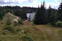
Durbaszka is entirely covered by forest on the southern, Slovak side. In this forest, there are limestone rocks known as Kościelne Skały. From the gaps between the trees, there are nice views of the Tatras. On the ridge and on the northern, Polish side, there are poloniny descending into the Grajcarek valley. Before World War II, it was farmland for the Lemkos from the village of Jaworki. Cattle grazed in the meadows, and part of the slopes was plowed. After the war and the expulsion of the Lemkos, a socialist production cooperative was established. At an altitude of 835 m, there is a mountain hut Durbaszka located below the summit.
From the upper, treeless part of the Durbaszka ridge, there are extensive views of the Radziejowa mountains and the Pieniny themselves. Currently, shepherds from Podhale graze flocks of sheep here. You can descend to the Jaworki - Szczawnica road via an unmarked path and the path around the hut, right at the parking lot before the Homole gorge. Along the way, there are several groups of limestone rocks, such as Sołtysie Skały, Czerszlowe Skalki, Czerszla, and a T-bar ski lift.
There is no chalet on the peak.
This peak is accessible with a stroller.
The summit is partially deforested, providing a nice view to the north of the Sadecké Beskydy and especially to the west of the neighboring peak Šľachovky and in the distance the dominant Trzy Korony.
There is no cable car to this peak.
No special equipment is required for this summit.
Peak is freely accessible.
Nearest peaks: Borsuczyny (939 m, 0.7 km) Stachurówki (938 m, 0.9 km) Bystrý hrb (791 m, 1 km) Rock (839 m, 1.1 km) Vysoký vrch (805 m, 1.2 km) Homole (727 m, 1.3 km) Kýčera (935 m, 1.6 km) Vysoké Skalky (1050 m, 1.6 km) Krupianka (688 m, 1.7 km) Pawłowska Góra (840 m, 1.8 km) Šľachovky/Wysoki Wierch (898 m, 1.8 km) Džánova skala (914 m, 2 km) Opalańczyk (711 m, 2.1 km) Ubocz (673 m, 2.1 km) Huściawa (818 m, 2.2 km) Predná Vrkolačka (675 m, 2.8 km) Czuprana (777 m, 3.3 km)
| today | tomorrow | day after tomorrow | |
|---|---|---|---|
| Dawn: | 5:45 | 5:46 | 5:48 |
| Sunrise: | 6:17 | 6:19 | 6:21 |
| Sunset: | 16:25 | 16:23 | 16:21 |
| Dusk: | 16:58 | 16:56 | 16:55 |







