


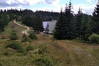




Hiking, 24 km
27.12.2025
 Polsko
Logged on Vrcholovka 2x in total. Vrchol Huściawa was added here by Bohumír Michal.
A peak in the ridge of the Small Pieniny, located on its northern, Polish slope below Rabsztyn, about 400 m from the Polish-Slovak border. To the north of Huściawa, a short ridge descends into the Grajcarek valley through Ubocz, separating the valley of the Palkovský stream from the Krupianka stream.
Huściawa is a low hill completely covered by forest. It was named by Józef Nyka, who knew this area from pre-war times, before the Lemkos were displaced. R. Walewski, the author of the study on Jaworki, believes that Nyka fell victim to a misunderstanding. He asked a woman from Jaworki for the name of this peak, and she only wanted to say that it has a dense forest, which in the Lemko language (a Rusyn ethnic group) means 'swaying.' In fact, in the village of Szlachtowa, which was inhabited by Lemkos before World War II, the name Huściawa was unknown; the residents simply did not need to name this peak. On the WIG map, it was described as Okrągły Wierch. The new post-war inhabitants of this area, who settled here after the displacement of the Lemkos, named this peak Księży Wierch because a Greek Catholic priest from the Slovak town of Wielki Lipnik had a field here.
In 2016, a leafless ground-covering moss (Buxbaumia viridis) - a rare protected species - was found on Huściawa.
There is no chalet on the peak.
Peak is not stroller accessible.
The peak is overgrown with forest and does not provide views.
There is no cable car to this peak.
No special equipment is required for this summit.
Peak is freely accessible.
Nearest peaks: Opalańczyk (711 m, 0.6 km) Rabštín (847 m, 0.6 km) Šľachovky/Wysoki Wierch (898 m, 0.7 km) Cyrhle (774 m, 0.8 km) Ubocz (673 m, 1.2 km) Czuprana (777 m, 1.3 km) Jarmuta (794 m, 1.4 km) Krupianka (688 m, 1.4 km) Lažna skala / Łaźne skaly (770 m, 1.6 km) Šľachtovský vrch (633 m, 1.7 km) Jarmutka (690 m, 1.9 km) Psia hora (690 m, 2.2 km) Tokárne (748 m, 2.2 km) Vysoký vrch (805 m, 2.4 km) Bystrý hrb (791 m, 2.8 km)
| today | tomorrow | day after tomorrow | |
|---|---|---|---|
| Dawn: | 5:48 | 5:49 | 5:51 |
| Sunrise: | 6:21 | 6:22 | 6:24 |
| Sunset: | 16:22 | 16:20 | 16:18 |
| Dusk: | 16:55 | 16:53 | 16:51 |


