




Hiking
so, 7.1.2023, 16:53
 Španělsko
Logged on Vrcholovka 2x in total. Vrchol Pico de Tehera was added here by Jiří Králík and info was completed by Martin Matějka.
The summit is accessible via a well-trodden path from the transmitter, which is reached by a gravel road.
There is no chalet on the peak.
Peak is not stroller accessible.
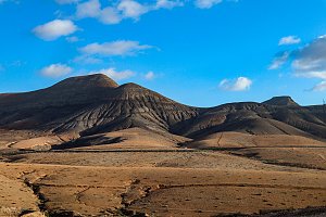
There are views from the peak.
There is no cable car to this peak.
No special equipment is required for this summit.
Peak is freely accessible.
Nearest peaks: Piedras de Tehera (448 m, 0.5 km) Cerro Bermejo (398 m, 0.8 km) Cuchillo del Ciervo (474 m, 1.5 km) Pico Alto (399 m, 1.5 km) Morro Jable (230 m, 1.6 km) Morro del Cavadero (753 m, 2.5 km) Talahijas (243 m, 2.5 km) Castillejo Alto (569 m, 3 km) Monte Redondo (153 m, 3 km) Pico de la Palma (744 m, 3 km) Montaña Vizcaíno (499 m, 3.1 km) Pico de la Zarza (814 m, 3.1 km) Los Castillejitos (420 m, 3.2 km) Torreta de Esquinzo (789 m, 3.3 km)
| today | tomorrow | day after tomorrow | |
|---|---|---|---|
| Dawn: | 6:40 | 6:40 | 6:41 |
| Sunrise: | 7:04 | 7:04 | 7:05 |
| Sunset: | 18:18 | 18:18 | 18:17 |
| Dusk: | 18:42 | 18:41 | 18:41 |