Montaña El Moro (667 m a.s.l., Fuerteventura)
Register and log summit

About peak Montaña El Moro
 Španělsko
Peak information here was completed by Jiří Králík a Martin Matějka.
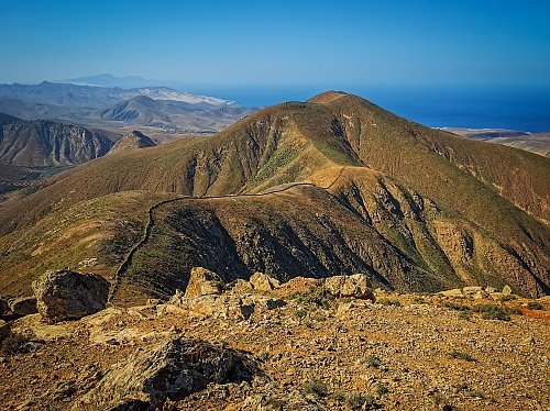
A peak from which you can plan a great ridge hike. A stone wall built by humans runs along the entire ridge. The best access is from the village of Vega de Rio Palmas, but don't expect any trails.
- Chalet/accommodation
-
There is no chalet on the peak.
- Stroller access
-
Peak is not stroller accessible.
- Views
-
There are views from the peak.
- Cable car
-
There is no cable car to this peak.
- Equipment
-
No special equipment is required for this summit.
- Accessibility
-
Peak is freely accessible.
Nearest peaks: Filo de la Galga (667 m, 0.3 km) Lomo Colorado (582 m, 0.6 km) El Morro (573 m, 1 km) Pico de la Aguililla (423 m, 1.5 km) Morro de la Silleta (630 m, 1.6 km) Alto de la Potranca (362 m, 1.9 km) Atalaya (726 m, 2 km) Morro de la Silleta (698 m, 2.3 km) La Atalayeja (286 m, 2.4 km) Risco de las Peñas (443 m, 2.5 km) Pico de la Muda (535 m, 2.7 km) Pico de la Muda (561 m, 2.9 km) Aceituno (422 m, 3.2 km) Morro Negro (485 m, 3.2 km) Risco Blanco (614 m, 3.2 km) Morro de los Sojames (310 m, 3.4 km) Pico Lima (632 m, 3.6 km)
Sun
| today | tomorrow | day after tomorrow | |
|---|---|---|---|
| Dawn: | 7:38 | 7:38 | 6:39 |
| Sunrise: | 8:02 | 8:02 | 7:03 |
| Sunset: | 19:19 | 19:18 | 18:17 |
| Dusk: | 19:43 | 19:42 | 18:41 |