



Hiking
út, 3.1.2023, 11:32
 Španělsko
Logged on Vrcholovka 1x in total. Peak information here was completed by Martin Matějka.
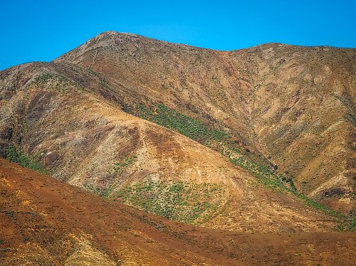
The highest mountain in the vast northern part of Fuerteventura. The ascent is not technically difficult, and you can use one of the ridges for the climb, or take advantage of the rocky bed of an occasional stream located at the northeastern foothill, which stretches up to the saddle between the peaks. The mountain is surrounded by a fence, and if you follow the mentioned stream bed, there is a passage that allows you to avoid climbing over or around it.
There is no chalet on the peak.
Peak is not stroller accessible.
There are views from the peak.
There is no cable car to this peak.
No special equipment is required for this summit.
Peak is freely accessible.
Nearest peaks: Morro de la Silleta (698 m, 0.3 km) Morro de la Silleta (630 m, 0.5 km) El Morro (573 m, 1 km) Filo de la Galga (667 m, 1.7 km) Alto de la Potranca (362 m, 1.8 km) El Peñón (462 m, 2 km) Montaña El Moro (667 m, 2 km) Lomo Colorado (582 m, 2.6 km) Morro del Corralete (661 m, 2.9 km) Pico de la Aguililla (423 m, 3 km) Morro de Tabagoste (629 m, 3.2 km) Cabezada Lomo las Casas (491 m, 3.3 km) Morro Malvasío (588 m, 3.3 km) Morro Rincón del Atajo (601 m, 3.3 km) Morro Negro (485 m, 3.4 km) Pico de la Muda (535 m, 3.4 km) Morro de la Cruz (678 m, 3.6 km) Risco de las Peñas (443 m, 3.8 km) Morrito del Rincón (607 m, 3.9 km) Morro de Velosa del Convento (676 m, 3.9 km) Morro de la Leña (356 m, 4.2 km)
| today | tomorrow | day after tomorrow | |
|---|---|---|---|
| Dawn: | 6:39 | 6:40 | 6:41 |
| Sunrise: | 7:03 | 7:04 | 7:05 |
| Sunset: | 18:16 | 18:15 | 18:14 |
| Dusk: | 18:40 | 18:39 | 18:38 |