

Hiking
út, 2.4.2024, 15:50
 Česko
Teplice (Ústecký kraj)
Logged on Vrcholovka 3x in total. Vrchol Ptačí vrch was added here by Pavel Soukup and info was completed by Tor.
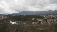
An elevated promontory above the meander of the Bíliny River, with views of Milešovka and Kletečná from the east of the plateau fields. In the western wooded area, the slopes drop in rocky steps. Smaller rock formations and scree are also found on the northern side just below the summit. Less than a quarter of a kilometer northeast of the summit, beautiful crossings can be found near the former mill on the Bíliny River.
There is no chalet on the peak.
Peak is not stroller accessible.
There are views from the peak.
There is no cable car to this peak.
No special equipment is required for this summit.
Peak is freely accessible.
Nearest peaks: Karolina (258 m, 0.7 km) Supí vrch (259 m, 1.4 km) U jezírka (302 m, 1.6 km) Lada (333 m, 2.1 km) Majka (322 m, 2.2 km) Pohradická hora (419 m, 2.2 km) Morový pahorek (315 m, 2.6 km) Hůrka (451 m, 2.8 km) Vinská hora (441 m, 3.2 km) Roudný (455 m, 3.4 km)
| today | tomorrow | day after tomorrow | |
|---|---|---|---|
| Dawn: | 6:10 | 6:11 | 6:13 |
| Sunrise: | 6:43 | 6:45 | 6:47 |
| Sunset: | 16:53 | 16:51 | 16:49 |
| Dusk: | 17:26 | 17:25 | 17:23 |