Igla (1207 m a.s.l., Western Tatras)
Register and log summit


About peak Igla
 Polsko
Logged on Vrcholovka 6x in total. Vrchol Igla was added here by Gregořicovi and info was completed by Martin Matějka a Rastislav Biarinec.
Igla is part of challenge: The Highest Peaks of the Western Tatras
Help others and .
- Chalet/accommodation
-
There is no chalet on the peak.
- Stroller access
-
Peak is not stroller accessible.
- Views
-
There are views from the peak.
- Cable car
-
There is no cable car to this peak.
- Equipment
-
No special equipment is required for this summit.
- Accessibility
-
Tatra National Park - the summit is located off the marked hiking trail.
Nearest peaks: Sarnia Skała (1377 m, 0.7 km) Długi Giewont (1867 m, 1.5 km) Wielki Giewont (1894 m, 1.9 km) Biała Giewoncka Baszta (1728 m, 2.2 km) Kondracka Kopka (1776 m, 2.2 km) Mały Giewont (1728 m, 2.2 km) Zadnia Giewoncka Baszta (1735 m, 2.2 km) Siodłowa Turnia (1647 m, 2.5 km) Gąsienicowy Wierch (868 m, 2.9 km) Koziniec (936 m, 3.2 km) Antalówka (937 m, 3.4 km) Kondratova kopa (2005 m, 3.4 km)
Routes nearby
(elevation gain 900 m, 13 km)
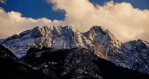 Výstup k chatě Hala Kondratowa a dále na Wielki Giewont ve Vysokých Tatrách
(elevation gain 920 m, 12 km)
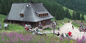 Výstup na Kościelec a Swinicu v polské části Vysokých Tater
(elevation gain 2600 m, 28 km)
 Výstup ke schronisku na Hali Ornak v Západních Tatrách
(elevation gain 1300 m, 16 km)
 Trek Dolinou Suchej Wody Gasienicowej v polské části Vysokých Tater
(elevation gain 1200 m, 21 km)
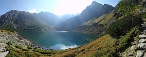 Trek v polských Tatrách - po Červených vrších s výstupem na Svinici
(20 km)
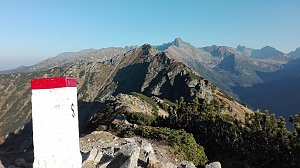 Orla Perc (Orlí stezka) v polských Vysokých Tatrách
(elevation gain 2200 m, 30 km)
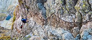 Orla Perc neboli Orlí stezka v Tatrách (z chaty Murowaniec)
(elevation gain 1800 m, 18 km)
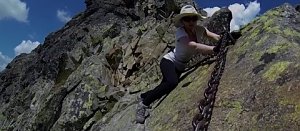 Túra dolinou Pieciu Stawow Polskich ve Vysokých Tatrách
(elevation gain 3300 m, 40 km)
Mountain chalets

Webcams
(830 m a.s.l., 3.2 km)
 Zakopane: Giewont − Widok na Tatry
(830 m a.s.l., 3.2 km)
 Szymaszkowa: Polana Szymoszkowa
(883 m a.s.l., 3.6 km)
 Kasprowy Wierch
(897 m a.s.l., 3.7 km)
 Zakopane: Rzeczpospolita
(816 m a.s.l., 3.8 km)
 Zakopane: PKL Kasprowy Wierch panorama
(1949 m a.s.l., 4.2 km)
 Zakopane: Kasprowy - Hala Gąsienicowa
(1954 m a.s.l., 4.3 km)
 Kuźnice: Kasprowy Wierch Dolina Gąsienicowa. System monitoringu pogody TOPR
(1970 m a.s.l., 4.3 km)
 Zakopane: Kasprowy - Panorama
(1965 m a.s.l., 4.3 km)
 Zakopane › South-East: Schronisko Murowaniec - Zadni Granat - Żółta Turnia
(1532 m a.s.l., 4.6 km)
 Zakopane › South-East
(324 m a.s.l., 4.7 km)
 Kościelisko: Czerwone Wierchy i Giewont
(981 m a.s.l., 4.7 km)
 Zab: Gubałówka - Zakopane
(1045 m a.s.l., 5.8 km)
 Zab: Widok na Tatry z Willi
(991 m a.s.l., 6.4 km)
 Harenda: widok z dolnej stacji
(777 m a.s.l., 6.6 km)
 Suche › South: Zakopane − Tatra National Park − Tatra Mountains
(976 m a.s.l., 6.8 km)
 Suche
( 6.8 km)

Sun
| today | tomorrow | day after tomorrow | |
|---|---|---|---|
| Dawn: | 6:41 | 6:42 | 5:44 |
| Sunrise: | 7:13 | 7:15 | 6:16 |
| Sunset: | 17:35 | 17:33 | 16:31 |
| Dusk: | 18:07 | 18:06 | 17:04 |