
Cycling, 102 km
18.9.2026
 Česko
Český Krumlov (Jihočeský kraj)
Logged on Vrcholovka 53x in total. Peak information here was completed by Martin Matějka, Bouřka a Josef Trajer.
Špičák is part of challenges: Backpack Full of Špičáks, Šumavské tisícovky, Šumavské ultratisícovky, The Highest Peaks of South Bohemia, Thousanders of the Czech Republic, Ultrapeaks
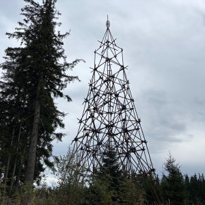
The third most prominent mountain of the Želnavská hornatina subrange in the southeastern part of Šumava and the highest Czech Špičák. Accessible since 2016 due to the reduction of the Boletice military training area. At the summit, there are remnants of the iron structure of a former military lookout tower, ascent at your own risk :)
Note: The stated height of 1221 m is the height of the geodetic point (1220.8 m), the height of the highest point is according to ags.cuzk.cz 1223.0 m.
There is no chalet on the peak.
Peak is not stroller accessible.
The summit is overgrown with trees, no view.
There is no cable car to this peak.
No special equipment is required for this summit.
Peak is freely accessible.
Nearest peaks: Nad Slatinkou (1188 m, 0.3 km) Špičák JV1 (1215 m, 0.3 km) Špičák JV2 (1174 m, 0.8 km) Špičák SV (1142 m, 0.8 km) Špičák S (1076 m, 0.9 km) Vlčí kámen (1138 m, 0.9 km) Nad Hospodárnicí (1187 m, 1.1 km) Kapradinec S (1099 m, 1.3 km) Nad Hospodárnicí Z2 (1181 m, 1.3 km) Kapradinec (1088 m, 1.4 km) Nad Hospodárnicí Z (1182 m, 1.5 km) Under the Triangle Z (969 m, 1.6 km) Under the Triangle (972 m, 1.7 km) U Dolnošpičácké cesty (949 m, 1.9 km) Hvězdáře (1160 m, 2 km) Kapradinec J (1003 m, 2 km) Nad Novým Špičákem (1084 m, 2.1 km) Under Žumberská Path (1033 m, 2.2 km) Nad Žumberskou cestou (1110 m, 2.4 km) Krb JZ (1075 m, 2.5 km) Nad Maňávkou (929 m, 2.5 km) Adolfův kámen (1073 m, 3 km) Lysá J (1133 m, 3 km) Umrlčí hlava (1150 m, 3.8 km)
 Přechod NP Šumava
 Přechod jižní Šumavou
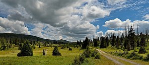 Kolem Lipna pěšky nebo na kole
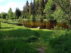
| today | tomorrow | day after tomorrow | |
|---|---|---|---|
| Dawn: | 6:07 | 6:08 | 6:10 |
| Sunrise: | 6:39 | 6:41 | 6:42 |
| Sunset: | 16:56 | 16:54 | 16:52 |
| Dusk: | 17:28 | 17:26 | 17:25 |