Berrio Blanc (3252 m a.s.l., Mont Blanc)
Register and log summit

About peak Berrio Blanc
 Itálie
Peak information here was completed by Martin Matějka.
Difficulty I/B-07.III-B
- Chalet/accommodation
- Stroller access
- Views
- Cable car
- Equipment
- Accessibility
Nearest peaks: Monte Ouille (3099 m, 3.6 km)
Routes nearby
Okružní výstup na vrchol Tete de la Tronche naproti Mont Blancu
(elevation gain 1900 m, 25 km)
 Výstup na nejvyšší vrchol Evropy normálkou - Mont Blanc
(elevation gain 2700 m, 17 km)
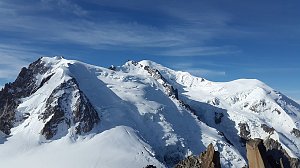 Z Itálie na vrchol Evropy - Monte Bianco neboli Mont Blanc
(elevation gain 3600 m, 35 km)
Routes provided by SvetOutdooru.cz
(elevation gain 1900 m, 25 km)
Výstup na nejvyšší vrchol Evropy normálkou - Mont Blanc(elevation gain 2700 m, 17 km)
Z Itálie na vrchol Evropy - Monte Bianco neboli Mont Blanc(elevation gain 3600 m, 35 km)
Webcams
Courmayeur: Youla
(2635 m a.s.l., 2.4 km)
 Courmayeur: Colle Checrouit, Pista Checrouit
( 3.8 km)
 Courmayeur: Col Checrouit
(2263 m a.s.l., 3.9 km)
 Porassey: La Thuile
(1850 m a.s.l., 5 km)
 Courmayeur: comprensorio di sci, pista Internazionale
(2024 m a.s.l., 5.3 km)
 Courmayeur: Versante Val Veny, Monte Bianco
( 5.3 km)
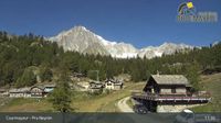
 Courmayeur: Pra Neyron
( 5.4 km)
 La Thuile
(1444 m a.s.l., 5.5 km)
 Dolonne: Courmayeur Plan Chécrouit
(1697 m a.s.l., 5.8 km)
 Courmayeur: Checrouit
(1673 m a.s.l., 5.8 km)
 La Thuile
(2167 m a.s.l., 6.9 km)

Cameras provided by windy.com
(2635 m a.s.l., 2.4 km)
Courmayeur: Colle Checrouit, Pista Checrouit( 3.8 km)
Courmayeur: Col Checrouit(2263 m a.s.l., 3.9 km)
Porassey: La Thuile(1850 m a.s.l., 5 km)
Courmayeur: comprensorio di sci, pista Internazionale(2024 m a.s.l., 5.3 km)
Courmayeur: Versante Val Veny, Monte Bianco( 5.3 km)
Courmayeur: Pra Neyron( 5.4 km)
La Thuile(1444 m a.s.l., 5.5 km)
Dolonne: Courmayeur Plan Chécrouit(1697 m a.s.l., 5.8 km)
Courmayeur: Checrouit(1673 m a.s.l., 5.8 km)
La Thuile(2167 m a.s.l., 6.9 km)
Sun
| today | tomorrow | day after tomorrow | |
|---|---|---|---|
| Dawn: | 7:30 | 6:32 | 6:33 |
| Sunrise: | 8:01 | 7:02 | 7:04 |
| Sunset: | 18:31 | 17:30 | 17:28 |
| Dusk: | 19:02 | 18:00 | 17:59 |