



Ski touring
po, 16.3.2026, 13:14
 Rakousko
Logged on Vrcholovka 1x in total. Peak information here was completed by Martin Matějka a Milan "Hojší" Průžek.
It lies on the border between Tyrol and Salzburg, in the main ridge of the Venediger group. It is well known from all sides due to its pyramid shape surrounded by large glaciers. This area is characterized by enormous glaciers with large crevasses and seracs beneath the mountains.
On the northern side, there is a huge glacier called Obersulzbachkees, above which rise the northern walls of Maurerkeeskopf (3313 m), Grosser Geiger (3360 m), Grossvenediger (3667 m), and others. The northern approach to Geiger leads over this glacier. On the eastern side, there is the Dorferkees glacier beneath the eastern wall. And on the southern side, there is the Maurerkees glacier. All glaciers are very large and have many crevasses.
Grosser Geiger has four large ridges. The northern ridge descends to the Obersulzbachkees glacier. The northeastern ridge descends into the notch of Obersulzbachtörl (2921 m) and continues to the summit of Großvenediger. The western ridge continues to the peaks of Maurerkeeskopf, and the southern ridge leads to the summit of Grosser Happ, 3350 m. This long ridge then drops over many small mountains into the Virgental valley.
Großer Geiger was first ascended on August 20, 1871, by climber Richard Issler and mountain guide Michael Groder from the southern mountain hut Johannishütte.
ROUTES:
South Route from the Maurer Tal valley via the Essener-Rostocker hut, 2208m, and further across the Maurerkess glacier to the summit. You can reach the summit from the glacier via the SW wall or the southern ridge.
Southeast Route: The starting point is the village of Hinterbichl, 1329 m from the Dorfer Tal valley to the Johannishuette hut, 2121 m, and further through the valley between Grosser Geiger and Großvenediger across the Dorferkess glacier to the notch of Obersulzbachtörl, 2921 m. From there, ascend via the SE ridge to the summit.
North Routes: From the Kürsinger hut (2547 m), you have two options. The first leads across the western part of the large Obersulzbachkees glacier to the notch of Maurer Törl. Then ascend via Maurerkess to the summit. You can reach the summit from the glacier via the SW wall or the southern ridge.
The second option leads directly from the hut to the notch of Obersulzbachtörl, 2921 m, and then via the SE ridge to the summit.
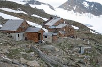
Today's normal route to Großer Geiger leads either from the Essener-Rostocker-Hütte (2208 m, usually open from early March to mid-May and from mid-June to early October, 50 beds, 50 mattresses, and 15 mattresses in the winter refuge) from the north or from the Kürsingerhütte (2547 m, usually open two weeks before Easter until the end of September, 50 beds, 100 mattresses, 20 emergency mattresses, and 16 mattresses in the winter refuge) from the south up to the western ridge of the mountain and then across the southwest slope as a glacier ascent to the summit cross.
A popular ski tour from the Essener-Rostocker Hütte. The ascent to Grosser Geiger from the southern side leads across the Maurerkees glacier. At an elevation of 2650 m, the route turns northwest and heads up a fairly steep slope towards the flat upper part of the glacier. Below the summit pyramid is a ski depot. The summit can be reached via easy terrain with crampons and an ice axe. Return via the same route to the hut.
Camping is not allowed in the national park, but alpine bivouacs are permitted.
A fee of €10.00 is charged for passing through the Felbertauern tunnel in each direction. Parking fees apply at the Streden parking lot. €3 for one day, €9 for a whole week.
There is no chalet on the peak.
Peak is not stroller accessible.
There are views from the peak.
There is no cable car to this peak.
Special equipment is required for this summit.
Peak is freely accessible.
 Výstup na vrchol Krisstalwand
 Výstup na vrchol Weisspitze
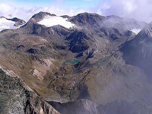 Výstup na Großvenediger přes Neue Prager Hütte
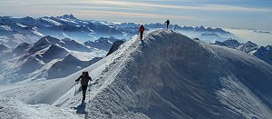 Letní výstup na Westliche Simonyspitze přes Umbalkees
 Adlerweg - Orlí stezka napříč Tyrolskem
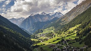
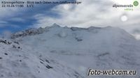 Marktgemeinde Neukirchen am Grossvenediger: Kürsingerhütte - Blick nach Süden zum Großen Geiger
 Gemeinde Pragraten am Grossvenediger › North

| today | tomorrow | day after tomorrow | |
|---|---|---|---|
| Dawn: | 6:13 | 6:14 | 6:16 |
| Sunrise: | 6:44 | 6:46 | 6:47 |
| Sunset: | 17:04 | 17:03 | 17:01 |
| Dusk: | 17:35 | 17:34 | 17:32 |