Blüemlisalphorn (3661 m a.s.l., Bernese Alps)
Register and log summit
Weather Blüemlisalphorn

About peak Blüemlisalphorn
 Švýcarsko
Peak information here was completed by Pája.
CH
Difficulty I/B-12.II-D
- Chalet/accommodation
- Stroller access
- Views
- Cable car
- Equipment
- Accessibility
Routes nearby
Výstup na Balmhorn – hraniční věž mezi Walliskými a Bernskými Alpami
(elevation gain 2000 m, 20 km)
 Výstup na vyhlídkový vrchol Schilthorn
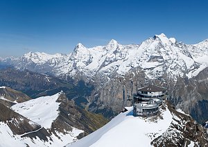
Routes provided by SvetOutdooru.cz
(elevation gain 2000 m, 20 km)
Výstup na vyhlídkový vrchol Schilthorn
Webcams
Kandersteg: Blüemlisalp
(2837 m a.s.l., 2.3 km)
 Kandersteg › North-West: Hohtürli
(2803 m a.s.l., 2.4 km)
 Kandersteg: Berghotel Oeschinensee - Oeschinen Lake - Blüemlisalp
(1607 m a.s.l., 4.6 km)
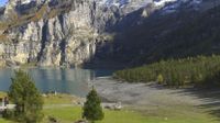 Kandersteg: Oeschinensee
(1607 m a.s.l., 4.6 km)
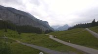 Kandersteg › North-East
( 5.7 km)
 Lauchernalp: Hockenhorngrat
(2899 m a.s.l., 6.8 km)
 Wiler
( 6.8 km)
Cameras provided by windy.com
(2837 m a.s.l., 2.3 km)
Kandersteg › North-West: Hohtürli(2803 m a.s.l., 2.4 km)
Kandersteg: Berghotel Oeschinensee - Oeschinen Lake - Blüemlisalp(1607 m a.s.l., 4.6 km)
Kandersteg: Oeschinensee(1607 m a.s.l., 4.6 km)
Kandersteg › North-East( 5.7 km)
Lauchernalp: Hockenhorngrat(2899 m a.s.l., 6.8 km)
Wiler( 6.8 km)
Sun
| today | tomorrow | day after tomorrow | |
|---|---|---|---|
| Dawn: | 6:29 | 6:30 | 6:32 |
| Sunrise: | 7:00 | 7:01 | 7:03 |
| Sunset: | 17:25 | 17:23 | 17:22 |
| Dusk: | 17:56 | 17:54 | 17:53 |