North Volcanic Zone
| Highest peak | Háhyrna (1539 m a.s.l.) |
|---|---|
| Most prominent peak | Háhyrna (1539 m a.s.l., prominence 601 m) |
| Parent unit | Island |
| Main peaks | Total 10 |
| Most popular peaks | Hverfjall (420 m a.s.l.), Námafjall (490 m a.s.l.), Leirhnjúkur (592 m a.s.l.), Vindbelgjarfjall (529 m a.s.l.), Rauðhólar (220 m a.s.l.) |

| Name | Elevation | ||||
|---|---|---|---|---|---|
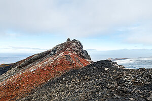
|
Háhyrna | 1539 m a.s.l. | North Volcanic Zone | 601 m | hlavní vrchol |

|
Askja | 1510 m a.s.l. | North Volcanic Zone | významný bod | |
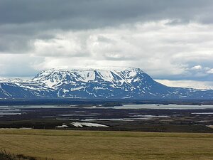
|
Bláfjall | 1222 m a.s.l. | North Volcanic Zone | 601 m | hlavní vrchol |

|
Biskupsfell | 1190 m a.s.l. | North Volcanic Zone | 44 m | hlavní vrchol |

|
Vadalda | 941 m a.s.l. | North Volcanic Zone | 281 m | hlavní vrchol |

|
Krafla | 818 m a.s.l. | North Volcanic Zone | 168 m | hlavní vrchol |

|
Leirhnjúkur | 592 m a.s.l. | North Volcanic Zone | 47 m | hlavní vrchol |

|
Vindbelgjarfjall | 529 m a.s.l. | North Volcanic Zone | 237 m | hlavní vrchol |

|
Námafjall | 490 m a.s.l. | North Volcanic Zone | 62 m | hlavní vrchol |

|
Hverfjall | 420 m a.s.l. | North Volcanic Zone | 80 m | hlavní vrchol |

|
Rauðhólar | 220 m a.s.l. | North Volcanic Zone | 35 m | hlavní vrchol |