King of the Kreuzeck Mountains King of the Kreuzeck Mountains

participants
2
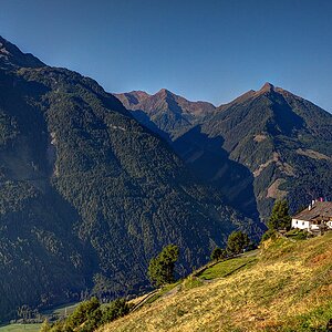
The Kreuzeck Mountains are among the lesser-known yet very charming ranges of the Austrian Alps. They lie between the valleys of the rivers Drava, Möll, and Isel in Carinthia and East Tyrol, overshadowed by their more famous neighbors (the High Tauern, the Schoberg range, or the Gailtal Alps).

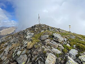
The highest peak of the range is Polinik (2,784 m with a prominence of 1,579 m), from where stunning views of the glaciers of the High Tauern, including the Großglockner massif, can be enjoyed. Unlike the dramatic limestone walls of the surrounding mountains, here wide grassy ridges, rounded peaks, and expansive alpine meadows prevail, creating an ideal terrain for long panoramic hikes.

Kreuzeck is a mountain range for those who prefer tranquility over crowded trails. Even during the main summer season, you will often encounter only a few hikers throughout the day. A dense network of marked paths connects mountain huts and allows for both day hikes and the multi-day Kreuzeck-Höhenweg, which is the most beautiful multi-day traverse of the range. The rewards include distant views, blooming alpine meadows, encounters with chamois or marmots, and a true sense of mountain freedom.

This challenge is ideal for anyone who wants to enjoy the Alps in their quieter and more authentic form and wishes to discover all the interesting nooks of the Kreuzeck Mountains.

Peak features in the challenge:
- elevation above 2000 m
- prominence above 150 m
- there is a route leading to it, including unmarked paths or via ferrata
- ascent is not prohibited
Mölltaler Polinik
2784 m n.m.
1579 m
Striedenkopf
2749 m n.m.
283 m
Hochkreuz
2709 m n.m.
294 m
Kreuzeck
2701 m n.m.
272 m
Scharnik
2657 m n.m.
213 m
Sandfeldkopf
2557 m n.m.
181 m
Grakofel
2551 m n.m.
237 m
Hochtristen
2536 m n.m.
169 m
Salzkofel
2498 m n.m.
233 m
Zietenkopf
2483 m n.m.
215 m
Stagor
2289 m n.m.
157 m
Share