
Hiking, 13 km
25.8.2026
 Česko
Karlovy Vary (Karlovarský kraj)
Logged on Vrcholovka 28x in total. Vrchol Popovský kříž was added here by Mountainer and info was completed by Martin Matějka.
Popovský kříž is part of challenges: Backpack Full of Špičáks, Cross on the Summit of Domestic Mountains and Hills
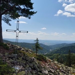
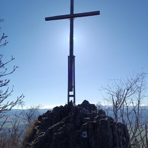
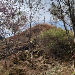
A viewpoint peak of basalt origin above the village of Horní Žďár. Alternative names are Popovský Špičák and Hvězda. Below the summit, there used to be a mountain village called Popov (Pfaffengrün), which was evacuated after World War II. Today, only the foundations of houses, the remains of a chapel, and four massive protected trees remain. At the summit stands a prominent cross, but during the communist regime, a star was placed at the viewpoint to motivate workers at Škoda Ostrov to meet their quotas, hence the unusual additional name. More experienced hikers can ascend to the summit via the green hiking trail from Horní Žďár, while less experienced ones are recommended to approach via the green or yellow hiking trails from Jáchymov.
There is no chalet on the peak.
While it is not possible to reach the summit and viewpoint with a stroller, a paved path leads from Jáchymov to the former Popov.
Views of Ostrov nad Ohří, the Karlovy Vary region, and partially the Doupov Mountains and Tepelsko Highlands. However, I recommend that fit hikers climb an additional 150 meters in elevation to the summit of Popovská hora (901 m), from where the view is incomparably better.
There is no cable car to this peak.
No special equipment is required for this summit.
Peak is freely accessible.
Nearest peaks: Bílý vrch (591 m, 1.7 km) Dívčí skok (657 m, 1.7 km) Popovská hora (901 m, 1.7 km) Popovská hora SV (895 m, 1.7 km) Nad dolem (690 m, 2 km) Under Kozí Peak (746 m, 2 km) Nad dolem S (681 m, 2.2 km) Čimický vrch (934 m, 2.9 km)
 Cyklostezka Ohře: na kole po krásách Karlovarského kraje
| today | tomorrow | day after tomorrow | |
|---|---|---|---|
| Dawn: | 7:12 | 6:13 | 6:15 |
| Sunrise: | 7:45 | 6:47 | 6:48 |
| Sunset: | 17:59 | 16:57 | 16:55 |
| Dusk: | 18:32 | 17:31 | 17:29 |