



Hiking, 21 km
10.9.2026
 Slovensko
Žilinský kraj
Logged on Vrcholovka 129x in total. Peak information here was completed by Frája, Bouřka, Šárka, Alexandr Starý a Martin Matějka.
Baníkov is part of challenges: The Highest Peaks of Roháče, Crown of the Tatras, Highest SK, Orava Basin, Slovensko 200+, TATRANSKÉ 2000 PO ZNAČCE, Tatranský turista, TATRY 2000/100, The Highest Peaks of the Western Tatras, Váh Basin
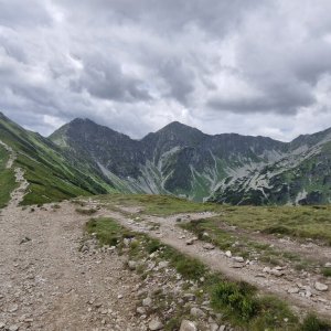
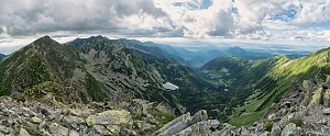
A prominent rocky tooth in the main ridge, part of the red ridge trail, the highest peak of the Roháče. The ascent from Baníkovské sedlo is relatively easy (by Tatra standards), but the approach from Hrubá kopa, along with the crossing of Ostrý Roháč, can be considered the most difficult section of the marked ridge areas of the Western Tatras. In good weather, the view is excellent.
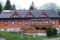
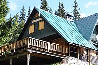
There is no chalet on the peak.
Peak is not stroller accessible.
There are views from the peak.
There is no cable car to this peak.
No special equipment is required for this summit.
Peak is freely accessible.
Nearest peaks: Baníkovská ihla (2096 m, 0.3 km) Príslop (2142 m, 0.4 km) Pachoľa (2167 m, 0.7 km) Hrubá kopa (2166 m, 0.9 km) Plačlivô nad Vrecom (2130 m, 0.9 km) Spálená (2083 m, 1.1 km) Tretia kopa (2133 m, 1.2 km) Druhá kopa (2132 m, 1.3 km) Gankova kopa (1980 m, 1.3 km) Tri kopy (2136 m, 1.4 km) Jalovecká kopa (1938 m, 1.7 km) Zelenô (2039 m, 1.7 km) Skriniarky (1930 m, 1.8 km) Predná Nohavice (2025 m, 2 km) Malý Salatín (2046 m, 2.2 km) Ráztoka (1950 m, 2.3 km) Ráztoka Z (1926 m, 2.4 km) Salatín (2048 m, 2.5 km) Brestová V (1883 m, 3.3 km) Brestová (1934 m, 3.4 km) Predná Zábrať (1577 m, 3.6 km)
| today | tomorrow | day after tomorrow | |
|---|---|---|---|
| Dawn: | 6:43 | 5:45 | 5:46 |
| Sunrise: | 7:16 | 6:17 | 6:19 |
| Sunset: | 17:34 | 16:32 | 16:31 |
| Dusk: | 18:07 | 17:05 | 17:03 |