Nagy-Tenke (332 m a.s.l., Zalská pahorkatina)
Register and log summit
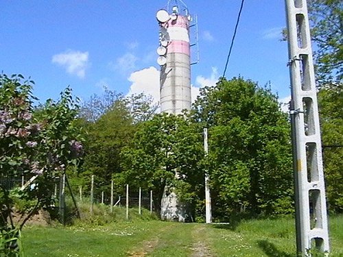

About peak Nagy-Tenke
Maďarsko
Vrchol Nagy-Tenke was added here by Martin Matějka and info was completed by Šimon Kozel a Martin Matějka.
One of the highest hills in the Hungarian-Slovenian mountain range, the Zalská pahorkatina. A geodetic measuring tower stands on the summit.
- Chalet/accommodation
-
There is no chalet on the peak.
- Stroller access
-
Peak is not stroller accessible.
- Views
- Cable car
-
There is no cable car to this peak.
- Equipment
-
No special equipment is required for this summit.
- Accessibility
-
Peak is freely accessible.
Nearest peaks: Pyramid (327 m, 2.1 km)
Sun
| today | tomorrow | day after tomorrow | |
|---|---|---|---|
| Dawn: | 6:13 | 6:15 | 6:16 |
| Sunrise: | 6:45 | 6:47 | 6:48 |
| Sunset: | 16:29 | 16:28 | 16:26 |
| Dusk: | 17:01 | 17:00 | 16:59 |