

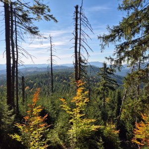

Hiking, 39 km
3.10.2026
 Česko
 Slovensko
Frýdek-Místek (Moravskoslezský kraj)
Logged on Vrcholovka 625x in total. Peak information here was completed by Horalka Anička, Alexandr Starý, Martin Matějka a buko1.
Čuboňov is part of challenges: Crown of the Moravian-Silesian Beskids, Czech-Slovak Ridge, Highest Peaks of the Moravian-Silesian Beskids, Nejhory Moravskoslezska, Thousanders of the Czech Republic
A mountain on the border Polom Ridge, 4 km southwest of Horní Lomná. On the western Slovak side, there is the Malý Polom National Nature Reserve, protecting fir-beech forests, while the Czech side is predominantly forested with spruce, with clearings in places. /tisicovky.cz
Height according to the elevation on Mapy.cz and local signs is 1014 m, while according to the digital model on skgeodesy.sk and Mapy.cz it is even 1017 m. The summit is located about 40 m beyond the border, within the National Nature Reserve. The nearest accessible point on the border is at 1012 m.
There is no chalet on the peak.
Peak is not stroller accessible.
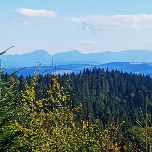
There are no views from the peak.
There is no cable car to this peak.
No special equipment is required for this summit.
the border of the National Nature Reserve is 40 m from the summit, the actual summit is not accessible
Nearest peaks: Čuboňov S (990 m, 0.5 km) Uhorská (1032 m, 0.8 km) Uhorská J (1029 m, 1 km) Olešniansky vrch (1017 m, 1.1 km) Malý Polom (1061 m, 1.3 km) Tyňok (935 m, 1.5 km) Uhorská JJV (945 m, 1.5 km) Burkův vrch Z (1022 m, 1.6 km) Nad Kršlí (1001 m, 2.1 km) Čerčok (800 m, 2.3 km) Kozí hřbety (986 m, 2.4 km) Polomka (984 m, 2.4 km) U Fujakov (730 m, 2.6 km) Okrouhlice J (813 m, 2.8 km) Polčany (817 m, 2.9 km) Vrchpredmier (828 m, 3.2 km) Okrouhlice (817 m, 3.3 km) Gruník J (704 m, 3.6 km)
| today | tomorrow | day after tomorrow | |
|---|---|---|---|
| Dawn: | 6:48 | 5:49 | 5:51 |
| Sunrise: | 7:21 | 6:22 | 6:24 |
| Sunset: | 17:38 | 16:36 | 16:34 |
| Dusk: | 18:11 | 17:09 | 17:07 |