Steinwald
| Highest peak | Platte (946 m a.s.l.) |
|---|---|
| Most prominent peak | Platte (946 m a.s.l., prominence 340 m) |
| Parent unit | Spruce trees |
| Main peaks | Total 8 |
| Most popular peaks | Platte (946 m a.s.l.), Hoher Saubadfelsen (858 m a.s.l.), Reiseneggerfelsen (845 m a.s.l.), Ruine Weißenstein (864 m a.s.l.), Schlossfelsen (913 m a.s.l.) |

| Name | Elevation | ||||
|---|---|---|---|---|---|

|
Platte | 946 m a.s.l. | Steinwald | 340 m | hlavní vrchol |

|
Schlossfelsen | 913 m a.s.l. | Steinwald | 20 m | hlavní vrchol |

|
Ruine Weißenstein | 864 m a.s.l. | Steinwald | 24 m | hlavní vrchol |

|
Hoher Saubadfelsen | 858 m a.s.l. | Steinwald | 38 m | hlavní vrchol |

|
Grandfelsen | 854 m a.s.l. | Steinwald | 23 m | hlavní vrchol |

|
Knockfelsen | 845 m a.s.l. | Steinwald | 18 m | hlavní vrchol |

|
Reiseneggerfelsen | 845 m a.s.l. | Steinwald | 15 m | hlavní vrchol |

|
Armesberg | 731 m a.s.l. | Steinwald | 140 m | hlavní vrchol |
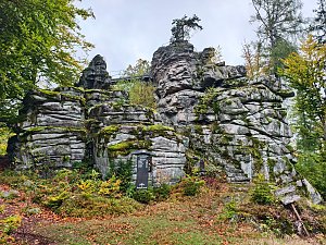
|
Hackelstein | 730 m a.s.l. | Steinwald | 12 m | vedlejší vrchol |
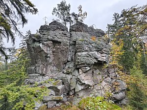
|
Hackel turm | 722 m a.s.l. | Steinwald | 8 m | vedlejší vrchol |