


Hiking, 53 km
5.7.2025
 Česko
Vyškov (Jihomoravský kraj)
Logged on Vrcholovka 3x in total. Vrchol Jaslůvka was added here by Jiřina and info was completed by Martin Matějka.
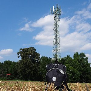
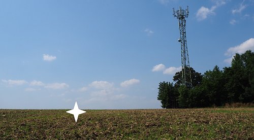
The summit is unmarked and lies in a field. Approximately 30m east of the hill's dominant feature - the transmitter.
A seating area with a view to the south. The northeast slope is forested with pine and young deciduous trees.
There is no chalet on the peak.
A well-maintained grassy path from Kozlany along the BLUE hiking trail allows access for strollers.
There are views from the peak.
There is no cable car to this peak.
No special equipment is required for this summit.
Peak is freely accessible.
Nearest peaks: Kozí Horka (342 m, 0.8 km) Šarcles (315 m, 0.9 km) Štotiny (329 m, 1.1 km) Malý Šarcles (302 m, 1.5 km) Hájek (325 m, 1.6 km) Malý Povětrník (316 m, 1.6 km) Srnčí vrch (358 m, 1.8 km) Dlouhé (312 m, 1.9 km) Padělky (356 m, 2.3 km) Reblovna (297 m, 2.3 km) Špinberk (357 m, 2.3 km) Holý kopec (374 m, 3 km) Řežavá (399 m, 3.1 km)
| today | tomorrow | day after tomorrow | |
|---|---|---|---|
| Dawn: | 6:52 | 6:54 | 5:55 |
| Sunrise: | 7:25 | 7:26 | 6:28 |
| Sunset: | 17:47 | 17:45 | 16:43 |
| Dusk: | 18:19 | 18:17 | 17:16 |