Rochlená S (664 m a.s.l., Beskydy)



About peak Rochlená S
Česko
Logged on Vrcholovka 1x in total. Vrchol Rochlená S was added here by Jiřina and info was completed by Martin Matějka.
The summit is not marked and should be located right next to the forest path.
- Chalet/accommodation
-
There is no chalet on the peak.
- Stroller access
-
Some quite significant elevation for a stroller.
- Views
-
There are no views from the peak.
- Cable car
-
There is no cable car to this peak.
- Equipment
-
No special equipment is required for this summit.
- Accessibility
-
A sign warning of private road does not directly prohibit passage from Búřov.
Nearest peaks: Rochlená (691 m, 0.1 km) Bečovská Kyčera (783 m, 0.8 km) Rozpité (621 m, 1 km) U Vašutků S (673 m, 1 km) Kamenné V (797 m, 1.1 km) U Vašutků (668 m, 1.1 km) Above the White Court (576 m, 1.3 km) Kamenné (745 m, 1.4 km) Požiska (596 m, 1.5 km) Požiska V (603 m, 1.5 km) Na Grúni (670 m, 1.9 km) Ježovec (626 m, 2.2 km) Under Ježovec Z (531 m, 2.4 km) Pod Ježovcem V (562 m, 2.6 km) Sent (576 m, 2.8 km) Radegast (1106 m, 3 km) Radegast Z1 (1100 m, 3 km) Radegast Z2 (1099 m, 3.1 km)
Routes nearby
Routes provided by SvetOutdooru.cz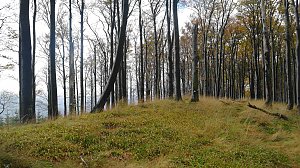
Webcams
(410 m a.s.l., 3.1 km)
 Radhošť Východ
(1101 m a.s.l., 3.4 km)
 Radhošť
(1098 m a.s.l., 3.4 km)
 Radhošť
(1102 m a.s.l., 3.7 km)
 Pustevny
(1010 m a.s.l., 4.1 km)
 Trojanovice › North-East: Pustevny Lanovka samoobslužná restaurace
( 4.2 km)

Sun
| today | tomorrow | day after tomorrow | |
|---|---|---|---|
| Dawn: | 6:28 | 6:30 | 6:31 |
| Sunrise: | 7:04 | 7:05 | 7:07 |
| Sunset: | 16:00 | 15:59 | 15:58 |
| Dusk: | 16:36 | 16:35 | 16:34 |