
Via ferrata, 11 km
15.8.2026
 Itálie
Logged on Vrcholovka 35x in total. Vrchol Marmolada was added here by Petr Papcun and info was completed by Petr Papcun, David.safec, Martin Matějka a Jan Blažej.
Marmolada is part of challenges: Ultraprominent Europe, Vápencové ultraperly východních Alp
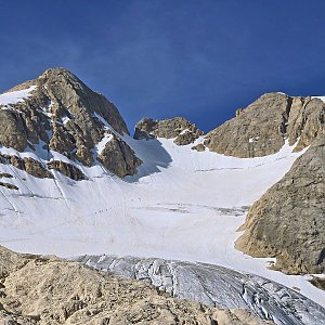
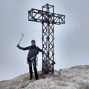
Marmolada (Ladin: Marmoleda, German: Marmolata) (3343 m a.s.l.) is the highest mountain in the Dolomites, which are part of the Alps. It is located east of Trento in northeastern Italy, about 100 kilometers north-northeast of Venice, from which it is visible on clear days. It consists of a ridge oriented from west to east. To the south, it almost vertically drops into a rock wall 2 km wide and 800 m high. On the northern side is the relatively flat Marmolada Glacier, the only large glacier in the Dolomites. A small mountain hut operates at the summit during the summer.
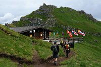
There is a chalet on the peak.
Peak is not stroller accessible.
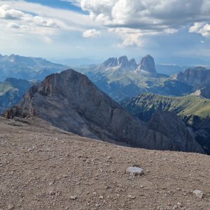
There are views from the peak.
There is no cable car to this peak.
glacier equipment
Peak is freely accessible.
Nearest peaks: Punta Penia SZ (3340 m, 0.1 km) Punta Penia Z1 (3265 m, 0.3 km) Punta Rocca (3310 m, 0.3 km) Punta Rocca V (2240 m, 0.4 km) Punta Rocca V2 (2250 m, 0.5 km) Punta Rocca V3 (2445 m, 0.5 km) Punta Rocca V4 (2240 m, 0.6 km) Punta Penia Z2 (3154 m, 0.7 km) Marmolada - Punta Rocca (3260 m, 0.8 km) Ombreta di Mezzo (2983 m, 1.1 km) Cima Ombreta (3011 m, 1.2 km) Gran Vernel (3210 m, 1.7 km) Sasso Vernale (3058 m, 1.9 km) Col de Bousc J (2486 m, 2.1 km) Col de Bousc (2491 m, 2.2 km) Ombretola (2923 m, 2.5 km)
 Výstup na Punta Serauta feratou Eterna – Brigata Cadore
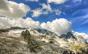 Marmolada - výstup na nejvyšší vrchol Dolomit
Feratová túra hřebenem Padon v Dolomitech
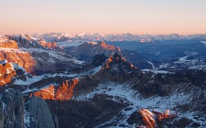 Výstup na Cima Ombretta
 Výstup na Piz Boe - nejlehčí třítisícovku v Dolomitech
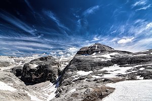
 Rocca Pietore › South-West: Marmolada
 Canazei: Arabba - Porta Vescovo
 Arabba: Portavescovo: Panorama Portavescovo
 Canazei: Funivia Ciampac - Colac - Gran Vernel
 Canazei: Colac
 Livinallongo del Col di Lana: Pordoi - Pass
 Soraga di Fassa
 Arabba: Marmolada - Pista Fodoma
 Vigo di Fassa: Passo Fedaia - Fedaia Lake - Marmolada - Ciampedie - Vigo Di Fassa - Rosengarten Group - Gran Vernel
 Livinallongo del Col di Lana: Arabba, Marmolada - Pista Fodoma
 Livinallongo del Col di Lana: Arabba, Marmolada - Pista Fodoma
 Livinallongo del Col di Lana: Arabba, Marmolada - Pista Fodoma
 Canazei › South-West: Refuge Sass Becè
 Soraga di Fassa
 Moena: Val di Fassa - Cima Uomo
 Canazei: Passo Pordoi - Pordoi Pass - Sass Pordoi - Sasso Pordoi - Piz Boè
 Soraga di Fassa
 Soraga di Fassa
 Soraga di Fassa
 Soraga di Fassa
 Canazei
 Moena

| today | tomorrow | day after tomorrow | |
|---|---|---|---|
| Dawn: | 7:11 | 6:13 | 6:14 |
| Sunrise: | 7:42 | 6:43 | 6:45 |
| Sunset: | 18:11 | 17:09 | 17:07 |
| Dusk: | 18:41 | 17:40 | 17:38 |