
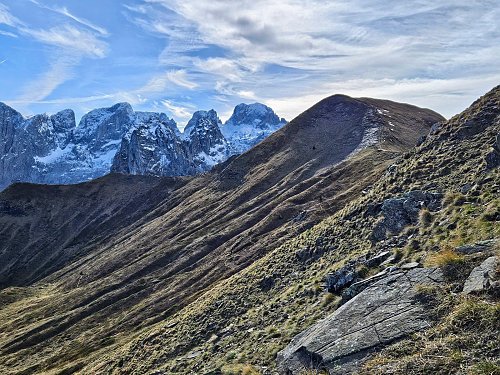



Hiking, 13 km
27.8.2023
 Albánie
 Černá Hora
Logged on Vrcholovka 5x in total. Vrchol Talijanka was added here by Jar Faldy and info was completed by Martin Matějka a Jan.
The easiest marked path to the summit leads from the Albanian village of Lepushë. The distance is just under four kilometers, and you need to overcome approximately 700 meters of elevation gain. A marked trail also leads from the Montenegrin side.
There is no chalet on the peak.
Peak is not stroller accessible.
From the summit of the mountain, there is a monumental view of the main ridge of Prokletije. I think it's one of the most beautiful viewpoints in Europe. The highest peaks of Prokletije are right at your fingertips from here.
There is no cable car to this peak.
No special equipment is required for this summit.
Peak is freely accessible.
Nearest peaks: Popadija (2030 m, 0.5 km) Valušnica (1879 m, 1.3 km) Karanfili - Veliki vrh (2490 m, 3.1 km) Northern Peak (2460 m, 3.1 km)
 Výstup na Volušnicu v pohoří Prokletije
| today | tomorrow | day after tomorrow | |
|---|---|---|---|
| Dawn: | 5:37 | 5:38 | 5:39 |
| Sunrise: | 6:05 | 6:07 | 6:08 |
| Sunset: | 16:44 | 16:42 | 16:41 |
| Dusk: | 17:12 | 17:11 | 17:10 |







