Mahya Dağı (1031 m a.s.l., Strandža)
Register and log summit
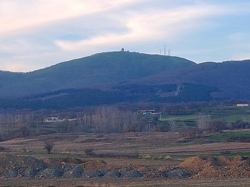

About peak Mahya Dağı
 Turecko
Logged on Vrcholovka 6x in total. Peak information here was completed by Martin Matějka a michal čech.
Mahya Dağı is part of challenges: Highest Geographical Points of Europe, Highest Mountains of European Countries
The highest mountain of the Strandža range and the European part of Turkey. There is a military base with a radar at the summit. About 3 km before the summit, a military area begins with a no-entry restriction.
- Chalet/accommodation
-
There is no chalet on the peak.
- Stroller access
-
Peak is not stroller accessible.
- Views
-
There are views from the peak.
- Cable car
-
There is no cable car to this peak.
- Equipment
-
No special equipment is required for this summit.
- Accessibility
-
military base
Sun
| today | tomorrow | day after tomorrow | |
|---|---|---|---|
| Dawn: | 7:02 | 7:03 | 7:04 |
| Sunrise: | 7:30 | 7:32 | 7:33 |
| Sunset: | 18:16 | 18:15 | 18:13 |
| Dusk: | 18:45 | 18:43 | 18:42 |