Hiking, 10 km
28.7.2022
 Česko
Vyškov (Jihomoravský kraj)
Logged on Vrcholovka 2x in total. Vrchol Žešov was added here by Jiřina and info was completed by Martin Matějka.
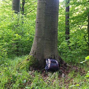
The summit is located in a mature deciduous forest and has a very dense undergrowth right at the peak, which is why no summit markings were found.
There is no chalet on the peak.
Winding and bumpy clay paths broken by the hooves of horses that evidently walk here often.
There are no views from the peak.
There is no cable car to this peak.
No special equipment is required for this summit.
Many forest paths are not shown on maps. According to GPS, you can go anywhere.
Nearest peaks: Orlov (385 m, 0.7 km) Humenice (437 m, 1.1 km) Malá Strana (399 m, 1.3 km) Na Klučích (321 m, 1.9 km) Klín (448 m, 2.3 km) Čeholec (328 m, 2.4 km) Řežavá (399 m, 2.4 km) Špinberk (357 m, 3.1 km) Srnčí vrch (358 m, 3.9 km)
| today | tomorrow | day after tomorrow | |
|---|---|---|---|
| Dawn: | 6:52 | 6:54 | 5:55 |
| Sunrise: | 7:25 | 7:26 | 6:28 |
| Sunset: | 17:46 | 17:45 | 16:43 |
| Dusk: | 18:19 | 18:17 | 17:15 |