
Peak is private

What does it mean? The peak was approved as private. It is therefore not an actual peak (not the highest point in its surroundings), but it exists so its author can log visits and count, for example, summits to a chalet or another point, or because the place is personally meaningful.

Jám (299 m a.s.l., Chřiby)

49.22517N, 17.46291E 0 m 13.3.2026 Mapy.cz
Jám
Uploaded: Jiřina

Weather Jám

Podpoř Vrcholovku!

About peak Jám

Česko Česko

Kroměříž (Zlínský kraj)

Logged on Vrcholovka 6x in total. Spočinek Jám was added here by Jiřina and info was completed by Martin Matějka.

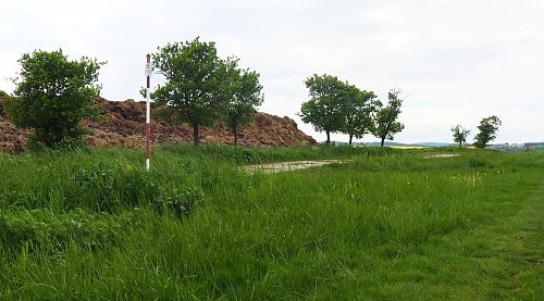
Geodetic point, without prominence. Marked by a pole, in close proximity to a permanent manure heap, a local landmark.

Chalet/accommodation

There is no chalet on the peak.

Stroller access

This peak is accessible with a stroller.

Views

There are views from the peak.

Cable car

There is no cable car to this peak.

Equipment

No special equipment is required for this summit.

Accessibility

Peak is freely accessible.

Nearest peaks: Čubovice (353 m,  2.5 km) Pod Pískem (367 m,  3.1 km) Soudná (344 m,  3.1 km) Dubník (325 m,  3.2 km)

Sun

today tomorrow day after tomorrow
Dawn: 6:52 5:54 5:55
Sunrise: 7:25 6:26 6:28
Sunset: 17:43 16:41 16:39
Dusk: 18:16 17:14 17:12

Visitor trips

Otrokovice
Tomik Krejda
Hiking, 29 km
23.11.2025
Velehrad - Olomouc 100.5 km
Lukas Kopunec
Hiking, 100 km
19.9.2024 to 20.9.2024
Lunch Ride
Marjanka
Hiking, 60 km
20.7.2024

Latest summits

Tomik Krejda - Jám
Tomik Krejda
Hiking
ne, 23.11.2025, 11:15
Lukas Kopunec - Jám
Lukas Kopunec
Hiking
čt, 19.9.2024, 22:38
Radka D on the summit of Jám (9.9.2024 11:45)
Radka D
Hiking
po, 9.9.2024, 11:45
Marjanka - Jám
Marjanka
Hiking
so, 20.7.2024, 15:48
Honza - Jám
Honza
Cycling
ne, 15.5.2022, 19:03
Jiřina on the summit of Jám (18.5.2021 14:34)
Jiřina
Hiking
út, 18.5.2021, 14:34
Share





