Palcíř (725 m a.s.l., Brdy)
Register and log summit


About peak Palcíř
 Česko
Rokycany (Plzeňský kraj)
Logged on Vrcholovka 9x in total. Vrchol Palcíř was added here by Martin Matějka and info was completed by Martin Matějka.
Palcíř is part of challenge: Nejhory Brd a Hřebenů
Photo by Djhipo Vladimír Hroch, Mapy.cz
- Chalet/accommodation
-
There is no chalet on the peak.
- Stroller access
-
Peak is not stroller accessible.
- Views
-
There are no views from the peak.
- Cable car
-
There is no cable car to this peak.
- Equipment
-
No special equipment is required for this summit.
- Accessibility
-
Inaccessible part of the former Kolvín shooting range.
The nearest accessible point is about 250 m to the north,
the highest accessible point is about 400 m to the east, 13 meters lower in elevation.
Nearest peaks: Palcíř V (722 m, 0.2 km) Palcíř SV2 (704 m, 0.3 km) Palcíř SZ (699 m, 0.3 km) Palcíř SV (704 m, 0.4 km) Palcíř SZ2 (680 m, 0.6 km) Palcíř SZ3 (658 m, 0.9 km) Under Palcíř (655 m, 0.9 km) Na Čihadle (649 m, 1 km) Under Palcířem NW (652 m, 1 km) Za Vrchy (697 m, 1.5 km) Stodůlky (654 m, 1.6 km) Nad Dršťkou (600 m, 1.7 km) Skála Marie Terezie (689 m, 1.7 km) Okrouhlík SSV2 (696 m, 2 km) Okrouhlík SSV (700 m, 2.1 km) Dubina J (626 m, 2.2 km) Na Slivíči (597 m, 2.2 km) Okrouhlík (708 m, 2.5 km) Okrouhlík JV (705 m, 2.6 km) Dubina (634 m, 3 km) Trokavecká skála (706 m, 3.4 km) Kamenná JZ (735 m, 3.5 km) Kamenná (736 m, 3.8 km)
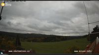
Webcams
Cameras provided by windy.com
Sun
| today | tomorrow | day after tomorrow | |
|---|---|---|---|
| Dawn: | 7:06 | 7:08 | 6:09 |
| Sunrise: | 7:39 | 7:40 | 6:42 |
| Sunset: | 17:59 | 17:57 | 16:55 |
| Dusk: | 18:32 | 18:30 | 17:28 |